Area Overview for Heatons South Ward
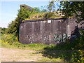
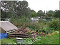
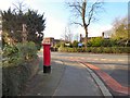
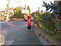
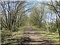
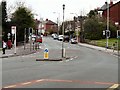
Photos of Heatons South Ward

Area Information
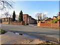
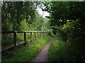
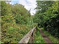
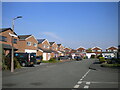
Heatons South Ward occupies a small but significant footprint within the Borough of Stockport, covering just 3.9 km². You will find this district centred in the Heaton Moor area, located approximately one mile from Stockport town centre. Originally part of Heaton Norris in Lancashire, the area joined Stockport in 1913 following boundary changes that redefined its administrative status. Today, it functions as a thriving residential and commercial suburb characterized by busy neighbourhood shopping centres. The history of the ward dates back to its time under the Heaton Norris Local Board until 1872, before evolving into a key component of the greater Manchester suburbs. You are moving into an estate that has been shaped by decades of development as a Manchester suburb. The local character is defined by the Heaton Moor Conservation Area, which was officially designated on 1 January 1973. This protection covers the core of the suburb, including both residential and commercial zones. When you consider living in Heatons South Ward, you enter a space where historical roots meet modern convenience. The ward serves as a distinct district borough unitary ward, balancing heritage with contemporary urban living. Its compact size ensures that the community remains relatively contained while staying connected to the wider county through established transport links.
- Area Type
- District Borough Unitary Ward
- Area Size
- 3.9 km²
- Population
- Not available
- Population Density
- Not available
Demographics
The community within Heatons South Ward presents a distinct demographic profile compared to the national average. The median age for residents is 70, making this a disproportionate area for older adults. You will find that the most common age range among the population aligns with this high median figure. This data indicates a settlement where retirement living or later-life relocation is a dominant trend. With a median age of 70, daily life here likely centres around amenities suited to an older cohort, including accessible housing and specific local services. Home ownership stands at 78%, which is a significant indicator of long-term stability and investment in the local estate. This high rate of ownership suggests that residents have deep ties to the neighbourhood and view these homes as permanent residences rather than transient rentals. The breakdown of household composition and accommodation types reflects this settled nature. While specific figures on household type are available in the dataset, the overarching narrative points toward a mature community. Ethical diversity and religious practice are part of the local tapestry, though specific predominant percentages are not detailed in the current records. Understanding who lives here means recognising a population that values the security of owning their home in a stable, age-focused environment like Heatons South Ward.
Household Size
Accommodation Type
Tenure
Ethnic Group
Religion
Household Composition
Age
Household Deprivation
NS-SEC
Explore more demographic insights in this area
Go to Demographics tabPlanning
Planning Constraints
- Flood RiskPremium
- Ramsar Wetland SitesPremium
- Area of Outstanding Natural BeautyPremium
- Protected Nature ReservePremium
- Protected WoodlandPremium
- Crime RiskPremium