Area Overview for Healey Ward
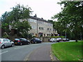
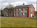
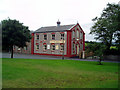
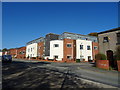
Photos of Healey Ward
Area Information
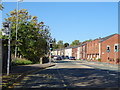
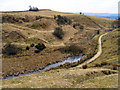
Living in Healey Ward offers a very specific type of settled life within the Metropolitan Borough of Rochdale. This district borough unitary ward covers a compact 4.1 km², creating a dense neighbourhood where most residents know their immediate surroundings. The area is defined by clear boundaries, including the significant stretch of Whitworth Road which forms part of its perimeter. You should understand that Healey is a mature community, distinguished by its homogeneity and deep-rooted character rather than rapid development. The ward is currently home to 1,249 people, a figure derived from the most recent data available. This small population creates a low-traffic environment, though you must be prepared for the realities of a specialised housing stock. Historically part of Lancashire before joining Greater Manchester, the area retains a strong sense of local identity separate from the wider city. While specific journey times or public transport details are not currently documented in the available records, the existence of structured ward boundaries suggests a planned, albeit compact, residential layout. Potential buyers here are entering a market characterised by stability and long-term residency rather than transient living. The physical footprint of the ward means that daily errands often require walking or local driving, framing a lifestyle tied closely to neighbourhood amenities.
- Area Type
- District Borough Unitary Ward
- Area Size
- 4.1 km²
- Population
- 1249
- Population Density
- 306 people/km²
Demographics
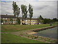
The community profile in Healey Ward is dominated by a senior demographic, reflected clearly in the data. This is not a young family area; the median age for residents is 70 years old. This indicates that the warehouses of the estate are filled with established households rather than new arrivals. Consequently, the social rhythm of Healey likely shifts earlier each evening compared to younger districts in Greater Manchester. Home ownership is a defining feature of this neighbourhood, with 72% of households owned outright or with a mortgage. This high ownership rate suggests a desire for stability and a dislike of frequent moves. The total household composition and accommodation type data provided covers the entire ward, reflecting a uniform living standard across the 4.1 km². While the data does not specify the predominant ethnic group or religious breakdown, the homogeneity of the age and ownership data implies a tightly knit, consistent community structure. You are likely to meet neighbours who have lived in their properties for decades, understanding the specific local history and quirks of Healey. This demographic makeup affects local services and engagement, tailoring the area towards the needs of older residents. It is a place where long-term settlement is the norm, and change happens slowly.
Household Size
Accommodation Type
Tenure
Ethnic Group
Religion
Household Composition
Age
Household Deprivation
NS-SEC
Explore more demographic insights in this area
Go to Demographics tabPlanning
Planning Constraints
- Flood RiskPremium
- Ramsar Wetland SitesPremium
- Area of Outstanding Natural BeautyPremium
- Protected Nature ReservePremium
- Protected WoodlandPremium
- Crime RiskPremium