Area Overview for Haverthwaite
Photos of Haverthwaite
Area Information
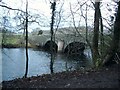
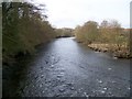
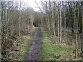
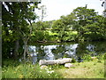
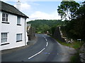
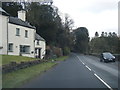
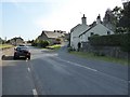
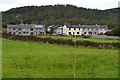
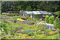
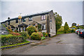
Haverthwaite is a civil parish located in the Lake District, covering a total area of 19.2 square kilometres. This parish offers a specific living environment defined by its proximity to protected natural sites rather than dense urban development. The landscape includes designated protected nature reserves and protected woodland, which influence the visual character of the region. You will also note the presence of Ramsar wetland sites within these boundaries, indicating significant ecological interest. Daily life here is shaped by these environmental factors, offering residents direct access to outdoor spaces that are legally safeguarded. Living in Haverthwaite means embracing a setting where nature conservation plays a central role. The area does not fall within an Area of Outstanding Natural Beauty, yet it stands independently as a distinct community with its own planning constraints. The size of the parish is substantial enough to provide a sense of space while remaining a manageable local unit. Homebuyers considering this location should understand the physical footprint they are purchasing into. The combination of wetlands, woodlands, and reserves creates a specific type of residential experience focused on tranquility and environmental awareness.
- Area Type
- Parish
- Area Size
- 19.2 km²
- Population
- Not available
- Population Density
- Not available
Demographics
The demographic profile of Haverthwaite reveals a distinctly mature community. The median age for residents is 70 years, a figure that indicates a population skewed heavily towards older adults. Although the data lists Age Total as the most common range, the median age confirms that life expectancy and residency patterns align with retirement demographics. You are looking at an area where the typical household consists of older individuals rather than young families or students settling down. Home ownership stands at 71 per cent, suggesting a stable residential stock where many people have settled permanently. This high level of ownership points towards a community built on long-term residency rather than temporary tenancies. The data indicates that household composition and accommodation types are aggregated, reflecting the broader residential mix found across the parish. Regarding diversity, the predominant ethnic group and religious demographics are recorded as totals, meaning the area reflects the general composition found across the region rather than having unique local anomalies. Residents here face a specific quality of life context defined by this age profile. The high home ownership rate means transactions often involve downsizing or moving within a similar age bracket. Deprivation and income data are not detailed in the specific breakdowns available for this parish, so you must rely on the age and ownership figures to gauge the community structure. The population centre is clearly established around needs and lifestyles of retirees.
Household Size
Accommodation Type
Tenure
Ethnic Group
Religion
Household Composition
Age
Household Deprivation
NS-SEC
Explore more demographic insights in this area
Go to Demographics tabPlanning
Planning Constraints
- Flood RiskPremium
- Ramsar Wetland SitesPremium
- Area of Outstanding Natural BeautyPremium
- Protected Nature ReservePremium
- Protected WoodlandPremium
- Crime RiskPremium