Area Overview for Haverigg
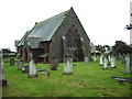
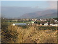
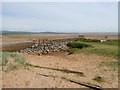
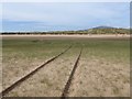
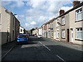
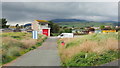
Photos of Haverigg


Area Information
Living in Haverigg means residing within a built-up area that spans 82.2 hectares across the Lake District region of Cumbria. This distinct community functions as a concentrated settlement where daily life revolves around local essentials and transport links to nearby towns. The area attracts those who value a grounded lifestyle while maintaining access to broader regional opportunities. You will find a neighbourhood defined by its specific boundaries and its integration into the wider Millom urban corridor. The setting offers a sense of place without the anonymity of a large city, making it a practical choice for families and individuals seeking stability. Your day-to-day existence here is shaped by the proximity to key rail stations and supermarkets, ensuring that essential errands remain short trips rather than full journeys. This balance of local convenience and regional connectivity defines the character of homes in Haverigg. You are part of a community where the pace of life moves to the rhythm of local needs and transport schedules. The area's size allows for a cohesive sense of community while still providing space for individual households. Understanding this footprint early helps you visualise your potential home life within these specific地理 boundaries.
- Area Type
- Built Up Area 250
- Area Size
- 82.2 hectares
- Population
- Not available
- Population Density
- Not available
Residents of Haverigg benefit from a practical range of amenities within walking or short driving distance. Five retail outlets serve the local community, including a Spar, Tesco Millom, and Co-op Askam. These supermarkets anchor the area, providing access to groceries and daily essentials without needing long journeys. You can find your weekly shop among these three major retailers, ensuring convenience is a core part of daily life. Transport links are equally accessible, with five rail stations providing connections to wider networks. Millom Railway Station, Silecroft Railway Station, and Green Road Railway Station form the backbone of public transport access for the area. Travelers can reach these stations easily from most homes in Haverigg, facilitating trips to the coast or the city centre. Barrow Walney Island Airport lies within practical reach, offering flight options for residents needing to travel further afield. This airport adds a layer of national connectivity that surpasses the mere presence of a town centre. The combination of supermarkets and rail stations creates a self-contained lifestyle where professional and social needs are met locally. You will spend less time commuting when so many amenities sit within your immediate sphere. This convenience is a defining feature of living in Haverigg.
Amenities
Schools
Families considering schools near Haverigg have one primary option listed within the immediate vicinity. Haverigg Primary School stands as the designated educational institution for the local children. This is a primary school with an Ofsted rating of good, indicating a standard of education that meets required national benchmarks. You can direct enquiries to this specific establishment for the primary education phase of a child's development. The school serves the local catchment area, providing education within the community itself rather than requiring transport to larger town centres for younger years. While Haverigg does not list secondary schools in the immediate neighbourhood data, this primary option provides a solid foundation for late childhood education. Parents should verify the secondary school arrangements through local council admissions, as this data only confirms the primary provision. The presence of a good-rated primary school supports the area's appeal to families who value educational stability from an early age. You will find that this single institution manages the primary needs of local school-age children. The rating suggests a curriculum and management style that inspectors have deemed satisfactory for student progress and welfare.
| Rank | School | Type | Entry gender | Ages |
|---|
Explore more schools in this area
Go to Schools tabDemographics
The community in Haverigg presents a clear demographic profile that reflects a settled population. The median age stands at 70 years, indicating a neighbourhood dominated by older residents. This age profile shapes the social fabric and leads to specific needs regarding local services and amenities. You will encounter a population where the majority of inhabitants fall into the senior age bracket. Home ownership is exceptionally high, with 83% of households owning their property outright or with a mortgage. This figure suggests a stable community where long-term residents have deep roots in the area. The remaining 17% of households consist of renters, reflecting a smaller but present tenant population. Accommodation types and ethnic composition are part of the local mosaic, though specific breakdown figures are not detailed in the current records. You can expect a homogeneous community in terms of age, creating a uniform environment for residents. This demographic reality influences local culture and neighbourly interactions, fostering a contained and predictable social atmosphere. For those considering relocation, knowing the age skew helps you anticipate the types of businesses and services that cater to this specific audience. The high ownership rate also points to a market driven by buyers rather than landlords.
Household Size
Accommodation Type
Tenure
Ethnic Group
Religion
Household Composition
Age
Household Deprivation
NS-SEC
Explore more demographic insights in this area
Go to Demographics tabPlanning
Planning Constraints
- Crime RiskPremium