Area Overview for Hankelow
Photos of Hankelow


Area Information
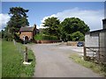
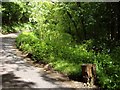
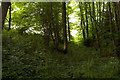
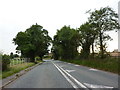
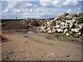
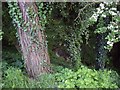
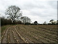
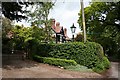
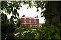
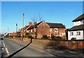
Living in Hankelow offers a distinctly rural experience within a civil parish that covers just 3.7 km². The small geographic footprint contributes to a close-knit environment where daily life moves at a slower pace than in larger towns. You will find yourself surrounded by open spaces rather than dense urban development, creating a quiet setting that contrasts sharply with the bustle of cities nearby. This locality represents a traditional English village feel, appealing to those who prioritise peace and proximity to nature over urban convenience. Residents here enjoy a sense of isolation that some seekers value for its tranquility, yet the limited size of the parish means facilities may not be extensive. The area sits within the wider landscape of East Worcestershire, providing a backdrop of Rolling countryside typical of the region. When you consider buying homes in Hankelow, you are choosing a specific slice of life defined by its residential focus and minimal commercial infrastructure. The community remains stable and established, reflecting the historical character of the parish. Daily commutes require planning, as transport links are not immediate. However, the quiet surroundings ensure that noise pollution is negligible for most properties. You should expect a lifestyle where walking distances to amenities might be a factor, though local shops likely serve immediate needs. The area stands as a distinct choice for buyers seeking greener living without the anonymity of a larger town. Understanding the scale of this 3.7 km² zone helps manage expectations regarding the convenience of services versus the benefit of a serene atmosphere.
- Area Type
- Parish
- Area Size
- 3.7 km²
- Population
- Not available
- Population Density
- Not available
Demographics
The community in Hankelow reflects a settled population with a median age of 70 years. This figure indicates that the majority of residents are older adults, likely retirees or those living beyond the prime working years. You will encounter a household composition skewed towards families with empty nesters, couples, or individuals rather than young professionals or families with small children. The demographics suggest a stable, established population where long-term residents outnumber newcomers. Home ownership in this parish stands at 81 per cent, meaning eight out of ten households own their property outright or have a mortgage. This high rate suggests financial stability among residents and a preference for staying put rather than renting. Consequently, the rental market is relatively small compared to the volume of owner-occupied homes. The age structure and ownership levels combine to create a neighbourhood where decisions to move are less frequent and property values may reflect stability over rapid turnover. You should anticipate a diverse range of accommodation types, though the data does not specify the exact breakdown between detached houses, bungalows, or terraced homes. The lack of younger residents in the median age suggests schools near Hankelow may serve families moving in from the surrounding areas rather than drawing from a local primary population. The prevailing ethnic and religious groups are recorded locally, but the dominant demographic trait remains the age profile. This older average does not imply a lack of activity, but rather a community centred on retirement living and life after career stages.
Household Size
Accommodation Type
Tenure
Ethnic Group
Religion
Household Composition
Age
Household Deprivation
NS-SEC
Explore more demographic insights in this area
Go to Demographics tabPlanning
Planning Constraints
- Flood RiskPremium
- Ramsar Wetland SitesPremium
- Area of Outstanding Natural BeautyPremium
- Protected Nature ReservePremium
- Protected WoodlandPremium
- Crime RiskPremium