Area Overview for Hambleton & Stalmine Ward
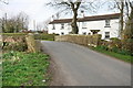
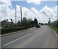
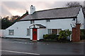
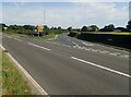
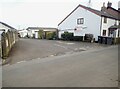
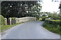
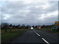
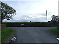
Photos of Hambleton & Stalmine Ward


Area Information
Hambleton & Stalmine Ward represents a tightly knit community within the UK's local government hierarchy, distinguished by its compact footprint and mature population. The ward covers a geographical area of 18.1 km² and is home to 1,822 residents. This results in a population density of 1,652 people per square kilometre, indicating a residential environment that is neither sprawling nor typified by high-density urban living. Living in Hambleton & Stalmine Ward offers a settlement experience defined by these specific boundaries and demographic realities. You will find a neighbourhood where residents are closely situated within roughly 18 square kilometres of land. The area functions as a defined district unitary ward, meaning it operates under specific local governance structures. Understanding these physical and administrative dimensions provides a clear picture of the locale itself. The scale ensures that daily life unfolds within a manageable and predictable environment for anyone considering making this their home.
- Area Type
- District Borough Unitary Ward
- Area Size
- 18.1 km²
- Population
- 1822
- Population Density
- 1652 people/km²
Demographics
The community of Hambleton & Stalmine Ward is characterised by an older demographic profile that shapes the social fabric of the area. The median age across this ward is 70 years, placing it significantly above the national average for most English regions. This age skew suggests that the majority of the population consists of older adults. You will find a society where services and daily interactions cater heavily to this older age group. Home ownership is a definitive feature of life here, with 84% of residents owning their property outright or with a mortgage. Consequently, the housing market is dominated by long-term residents rather than transient households or private rental sectors. While the provided data marks household composition and ethnic diversity as general totals, the overwhelming reliance on owner-occupied homes creates a stable, established neighbourhood. Deprivation indicators are not quantified in the current figures, but the high registration of homeownership generally correlates with financial security within this age bracket. Residents here can expect a mature society where the majority possess a vested interest in the permanence of their homes.
Household Size
Accommodation Type
Tenure
Ethnic Group
Religion
Household Composition
Age
Household Deprivation
NS-SEC
Explore more demographic insights in this area
Go to Demographics tabPlanning
Planning Constraints
- Flood RiskPremium
- Ramsar Wetland SitesPremium
- Area of Outstanding Natural BeautyPremium
- Protected Nature ReservePremium
- Protected WoodlandPremium
- Crime RiskPremium