Area Overview for Hambleton
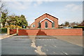
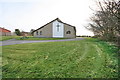
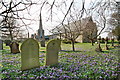
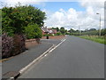
Photos of Hambleton

Area Information
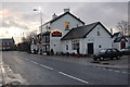
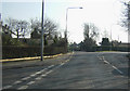
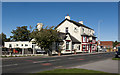
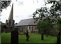
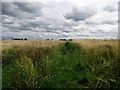
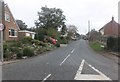
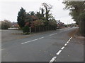
Living in Hambleton means residing within a small civil parish located on the Hambleton Peninsula in Rutland. This area sits between the arms of the Rutland Water reservoir, approximately two miles east of Oakham. The village covers an area of 6.6 square kilometres and is defined by its picturesque countryside and scenic peninsula setting closed off on three sides by water. Hambleton was rated among the 20 most beautiful villages in the UK and Ireland by Condé Nast Traveler in 2020. Residents enjoy views across Rutland Water, bluebell woods, and a tranquil lakeside atmosphere. The local architecture features the Grade II* listed 12th-century St Andrew's Church, which stands as a historic focal point. You will find notable landmarks including Hambleton Hall, a prominent hotel and restaurant, and The Finch's Arms pub. The parish includes Hambleton Wood forest and the Lagoon 3 nature reserve, while walking and cycling tracks run along the lakeside. This location offers a blend of quiet rural life and access to significant recreational spaces within the East Midlands of England.
- Area Type
- Parish
- Area Size
- 6.6 km²
- Population
- Not available
- Population Density
- Not available
Demographics
The community in Hambleton has a distinct demographic profile with a median age of 70 years. The population data indicates a large proportion of residents fall into the older age bracket, reflecting the retirement appeal of the village. Home ownership is prevalent in this parish, with 83% of households owning their property outright or with a mortgage. This high rate suggests a stable, settled community where long-term residents have stayed throughout decades. Regarding household composition and accommodation types, the available data confirms a pattern typical of rural retirement destinations. While specific ethnic group statistics and religious affiliation figures are recorded in local datasets, the primary defining characteristic of the population is its advanced age. This demographic structure influences local services and social activities, catering primarily to older adults. The safety score for the area is 74 out of 100, which categorises the neighbourhood as having below-average crime rates. This low crime risk contributes to the perception of a peaceful environment suitable for older residents seeking a quiet life away from city centres.
Household Size
Accommodation Type
Tenure
Ethnic Group
Religion
Household Composition
Age
Household Deprivation
NS-SEC
Explore more demographic insights in this area
Go to Demographics tabPlanning
Planning Constraints
- Flood RiskPremium
- Ramsar Wetland SitesPremium
- Area of Outstanding Natural BeautyPremium
- Protected Nature ReservePremium
- Protected WoodlandPremium
- Crime RiskPremium