Area Overview for Halewood
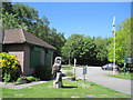
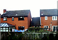
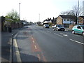
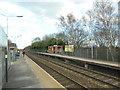
Photos of Halewood

Area Information
Halewood is a civil parish situated in England, covering an area of 10.4 square kilometres. With a population of 10,962, this location hosts a significant community within a relatively compact footprint. The density of 1,054 people per square kilometre indicates a residential settlement that is neither extremely rural nor densely packed like a major city centre. Living in Halewood offers residents a specific character defined by these clear geographical boundaries and population metrics. You find yourself in a defined place where daily life revolves around the needs of nearly 11,000 individuals spread across 10.4 square kilometres. This demographic concentration shapes the local services and infrastructure available to those buying homes in the area. The size of the parish provides enough space for residential development while maintaining a sense of locality. Understanding these fundamentals is essential when considering your next move. The statistical reality of the area forms the backbone of the living experience here.
- Area Type
- Parish
- Area Size
- 10.4 km²
- Population
- 10962
- Population Density
- 1054 people/km²
Demographics
The community in Halewood presents a clear demographic picture defined by age and household stability. The median age stands at 70 years, which signals that the population consists largely of older residents. Most common age ranges align with this high median, suggesting a mature neighbourhood where family life may look different than in younger urban districts. Home ownership represents a core feature of life here, with 68% of residents owning their property outright or with a mortgage. This high level of ownership implies a stable, settled community where people have made long-term commitments to their properties. Household composition data reflects this stability, showing a total mix that supports established living patterns. Accommodation types and predominant ethnic groups form the fabric of this diverse yet settled population. Religious affiliations contribute further to the cultural landscape of the parish. When you look at the numbers, the area feels like a established home for the elderly and long-term residents rather than a commuter belt for young professionals.
Household Size
Accommodation Type
Tenure
Ethnic Group
Religion
Household Composition
Age
Household Deprivation
NS-SEC
Explore more demographic insights in this area
Go to Demographics tabPlanning
Planning Constraints
- Flood RiskPremium
- Ramsar Wetland SitesPremium
- Area of Outstanding Natural BeautyPremium
- Protected Nature ReservePremium
- Protected WoodlandPremium
- Crime RiskPremium