Area Overview for Hale Bank
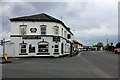
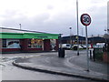
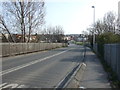
Photos of Hale Bank


Area Information
Living in Hale Bank means residing in a built-up area of 35.1 hectares that functions as a distinct town within the wider Consett and St Helens landscape. You are located in a community where daily life is defined by practical accessibility rather than vast suburban sprawl. The area stands as a cohesive residential hub where locals access essential services without needing to travel far for routine needs. Families and individuals seeking a settled neighbourhood find this location offers a compact environment where the local amenities are within practical reach. The character of Hale Bank is shaped by its history as a functional town centre, providing a sense of permanence and community focus. While the area is not a sprawling metropolis, its density ensures that social interactions and local commerce remain vibrant. Residents here enjoy the benefits of a self-contained locality where shops, transport links, and services are concentrated. This concentration fosters a homebuyer-focused mindset where convenience and local knowledge drive the daily rhythm of life. You will find yourself in a place where the boundary between home and local services is short, supported by a network of rail connections and essential retailers. For anyone considering moving to this part of the country, the reality is that Hale Bank offers a straightforward, low-maintenance lifestyle centred on local infrastructure. The area does not boast dramatic scenery or luxury settings, but it provides a stable foundation for permanent living. Households here rely on a well-connected network of services that support a balanced routine. Whether you need to visit a local grocer or catch a train, the layout of the area puts these necessities immediately at your disposal.
- Area Type
- Built Up Area 250
- Area Size
- 35.1 hectares
- Population
- Not available
- Population Density
- Not available
Your daily routine in Hale Bank relates closely to the five major retail outlets within immediate reach. Co-op Hale, Spar, and Morrisons Daily serve as your primary sources for groceries and household supplies. Having these three major retailers nearby means you can complete most shopping tasks without leaving the neighbourhood. You will find fresh produce, household essentials, and general merchandise just minutes away from your front door. This convenience reduces the need for long commutes to regional shopping centres. Transport options enhance this lifestyle by providing five distinct rail connections to nearby stations such as Hough Green and Halewood. You do not need a car to access major cities or travel hubs. The presence of two airports in the vicinity, specifically Liverpool John Lennon Airport, ensures you can schedule private or long-haul travel without complex logistics. These amenities create a self-sufficient environment where work lifetimes are supported by local commerce and efficient transit. Families and individuals benefit from a neighbourhood character defined by accessibility. The area size of 35.1 hectares confines these amenities to a walkable distance for many residents. You will encounter a mix of local businesses and larger chains that cater to daily needs. There is no reliance on distant high streets for basic requirements. This concentration of services supports a balanced lifestyle where time saved in travel adds up to more time for family or leisure. The lifestyle here is practical and utilitarian, focused on ease of living rather than exclusive leisure venues. You can manage your entire week with minimal travel. The reliability of the local amenities ensures that your quality of life remains consistent regardless of weather or traffic conditions.
Amenities
Schools
Families considering Hale Bank will find a primary education option in Halebank CofE Primary School. This institution holds a 'good' Ofsted rating, indicating a standard of education that meets expected benchmarks. The school serves as a central educational resource for the younger population in the locality. School type analysis reveals a reliance on one specific primary provider listed within the immediate vicinity of the data. The absence of secondary school data in the provided records means you must look outward for older children's education. Parents in Hale Bank may need to send pupils to schools in neighbouring towns or communities beyond the immediate built-up area. This arrangement is common in smaller towns where one large local secondary institution serves a wider district. The 'good' rating at Halebank CofE Primary School suggests a positive start for children entering formal education within the Hale Bank catchment. For those choosing schools near Hale Bank, the presence of a single primary school with a solid rating provides a clear focal point for early years. However, the lack of listed secondary options means you must research the nearest high schools separately. The school mix in this area is therefore narrow, focusing heavily on the primary phase. Commutes to secondary education may involve travel by car or bus to centres outside Hale Bank. This logistical consideration is a key factor for families weighing the pros and cons of relocation to this specific built-up area.
| Rank | School | Type | Entry gender | Ages |
|---|
Explore more schools in this area
Go to Schools tabDemographics
The community in Hale Bank is distinctively older than the national average, with a median age of 70 years. This figure highlights that the population is dominated by retirees and older residents who have settled in the area. You are not posting on a typical young professional quarter or a family-only estate, but rather living amidst a mature demographic where stability often precedes transience. The most common age grouping reflects this senior-heavy profile, meaning your neighbours are likely to be long-term residents who know the local history. Home ownership stands at 58%, indicating that more than half of the households in this locality own their homes outright or with a mortgage. This high level of tenure suggests a community invested in the long-term value of Hale Bank properties rather than short-term rental arrangements. The dominance of owner-occupied homes contributes to a slower pace of life, as these residents are often less prone to frequent moves. You will find that the accommodation stock reflects this stability, with many properties having been in the same families for generations. While the data does not break down specific ethnic groups or religious affiliations in detail, the demographic profile speaks to a homogeneous community in terms of age. There is no indication of a transient renting population shifting the social balance. Instead, the 58% ownership rate paints a picture of a neighbourhood where people have put down roots. This contrasts with areas where the rental market might foster a more fluid and shifting social dynamic. For you, this translates into a settled environment where local traditions and community roles are well established.