Area Overview for Great Eccleston
Photos of Great Eccleston


Area Information
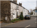
Great Eccleston occupies 82.7 hectares as a built-up area within Lancashire, England. It functions as a residential settlement distinct from major urban centres yet well-connected to surrounding communities. You will find a community defined largely by its established character and high level of local ownership. The area is situated close to significant railway infrastructure, granting quick access to Kirkham and Wesham or Poulton and Salwick stations. This positioning makes it practical for commuters seeking a northern stop for the Pendle or Ribble Valley lines. Daily life here involves relying on a few specific retail chains rather than a sprawling mall environment. Residents access Spar, Spar Hambleton, or the larger Aldi store in nearby Kirkham for essential shopping needs. The neighbourhood balances quiet living with functional connectivity to wider Lancashire transport networks.
- Area Type
- Built Up Area 250
- Area Size
- 82.7 hectares
- Population
- Not available
- Population Density
- Not available
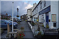
Your daily convenience in Great Eccleston relies on a selective range of nearby amenities within practical reach. Five retail outlets are documented as the primary shopping resources for the area. You can visit Spar, Spar Hambleton, or the larger Aldi store located in Kirkham for groceries and essentials. These five shops form the backbone of local commerce, offering a straightforward approach to weekly shopping without the need for dramatic retail expansions. Rail travel remains a key lifestyle feature, with three railway stations serving the immediate zone. Kirkham and Wesham Railway Station and Poulton Railway Station provide direct links to larger cities. Salwick Railway Station offers additional connectivity for those needing to travel further east. The absence of broader leisure centres or entertainment venues means your social life revolves around home or planned trips to larger town centres.
Amenities
Schools
Families living in Great Eccleston have access to St Mary's Catholic Primary School, Great Eccleston. This institution serves the locality as a primary education option. The school data provided in this report lists this specific name twice, ensuring it is the nearest provider listed for your consideration. There are no secondary schools or state-funded academies specifically named in the available information for immediate proximity. You must plan ahead if your children require education beyond the primary stage, as the listed data focuses solely on this one school type. The repetition of the school name in the dataset confirms its significance as the local hub for early education. Prospective parents should verify current Ofsted ratings through official channels, as specific ratings are not included in the summary data. Your options for secondary education will require travel to nearby towns or integrated academies outside the immediate neighbourhood perimeter.
| Rank | School | Type | Entry gender | Ages |
|---|
Explore more schools in this area
Go to Schools tabDemographics
The population profile in Great Eccleston reflects an established community with a notable age skew. Residents have a median age of 70, indicating this is a neighbourhood for retirees and older families. Most households fall into the total age bracket, suggesting a steady demographic without extreme fluctuations. A significant 83% of homes in Great Eccleston are owner-occupied, revealing a deeply rooted sense of community ownership. This high ownership rate contrasts with many modern rental estates or university towns nearby. While the data highlights the dominant age group, it does not detail specific breakdowns for every single cohort. The area maintains a stable social fabric where long-term residents form the majority. You are entering a market where people have chosen to stay and put down roots rather than treat the area as a temporary base.
Household Size
Accommodation Type
Tenure
Ethnic Group
Religion
Household Composition
Age
Household Deprivation
NS-SEC
Explore more demographic insights in this area
Go to Demographics tabPlanning
Planning Constraints
- Crime RiskPremium