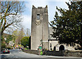
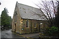
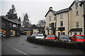
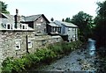
Area Overview for Grasmere
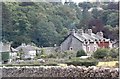
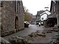
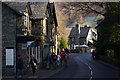
Photos of Grasmere

Area Information
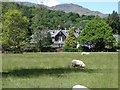
Grasmere is a small built-up area in England, covering 38.6 hectares. It is a quiet, compact community where daily life is shaped by its modest size and proximity to natural and local amenities. The area’s population has a median age of 70, suggesting a community leaning towards older residents, many of whom may have lived in the area for decades. Living in Grasmere offers a mix of local retail, ferry access, and a sense of close-knit living. The area’s charm lies in its accessibility to nearby towns like Ambleside, with ferry landings providing easy travel to surrounding lakes and villages. While the population is small, the presence of shops such as Co-op Grasmere and Budgens Ambleside ensures basic needs are met. For those seeking a tranquil yet connected lifestyle, Grasmere balances simplicity with practicality, though its limited size means it is not suited for those requiring extensive urban infrastructure.
- Area Type
- Built Up Area 250
- Area Size
- 38.6 hectares
- Population
- Not available
- Population Density
- Not available
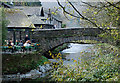
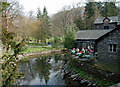
Living in Grasmere offers access to a range of local amenities that contribute to a simple, community-focused lifestyle. The area has five retail outlets, including Co-op Grasmere, Langdale Co-operative Society, and Budgens Ambleside, ensuring basic shopping needs are met. These shops serve as focal points for daily life, offering convenience for residents. Three ferry landings—Ambleside Waterhead Ferry Landing, Wrey Castle Ferry Terminal, and Brockhole Ferry Landing—provide easy access to nearby lakes and villages, enhancing opportunities for leisure, travel, and commuting. While the area lacks larger leisure facilities, the ferry network connects residents to broader recreational options. The presence of these amenities fosters a sense of self-sufficiency, though those seeking extensive retail or entertainment may need to travel to nearby towns. Grasmere’s lifestyle is defined by its compactness and reliance on nearby connections.
Amenities
Schools
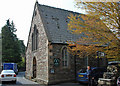
Grasmere CofE Primary School is the only school listed in the area, catering to primary education with an Ofsted rating of ‘good’. This school serves the local community, providing a foundation for young learners. The absence of secondary schools in the data suggests that families may need to consider commuting to nearby towns for further education. For those prioritising primary schooling, Grasmere CofE Primary offers a reliable option, though parents should plan for secondary education elsewhere. The single school in the area highlights the need for proximity to other educational institutions, which may influence decisions about where to live. Families with children may find it essential to assess the availability of secondary schools in surrounding areas when considering Grasmere as a long-term home.
| Rank | A + A* % | School | Type | Entry gender | Ages |
|---|---|---|---|---|---|
| 1 | N/A | Grasmere CofE Primary School | primary | N/A | N/A |
Explore more schools in this area
Go to Schools tabDemographics
The population of Grasmere has a median age of 70, indicating a community predominantly composed of older residents. This age profile suggests a demographic where retirees or long-term residents form the majority. Home ownership in the area stands at 46%, meaning nearly half of residents rent their homes. This figure implies a rental market that may cater to those seeking temporary or flexible housing. The data does not specify household composition or ethnic diversity, but the overall population appears to be a mix of long-established residents and those newer to the area. The age demographic may influence local services, with healthcare and leisure facilities likely tailored to older adults. While the area’s characteristics are not explicitly tied to deprivation levels, the lower home ownership rate could indicate a reliance on local rental options or shared living arrangements.
Household Size
Accommodation Type
Tenure
Ethnic Group
Religion
Household Composition
Age
Household Deprivation
NS-SEC
Explore more demographic insights in this area
Go to Demographics tabPlanning
Planning Constraints
- Crime RiskLocked