Area Overview for Gowy Rural Ward
Photos of Gowy Rural Ward


Area Information
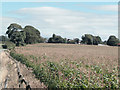
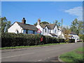
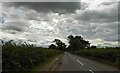
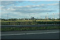
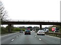
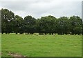
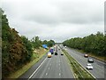
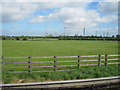
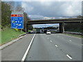
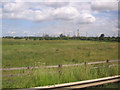
Gowy Rural Ward represents a distinctly rural enclave within Cheshire West and Chester, covering an area of 76.6 square kilometres. You will find the ward situated on the border region between Cheshire and Wales, characterised by open countryside rather than urban development. The local atmosphere reflects Cheshire farmland and open country, preserving the environment closest to Chester through greenbelt designation. This ward had an approximate population of 9,273 as of recent census data, though current official figures indicate 2,971 residents. The landscape is defined by the Gowy River, which rises in Peckforton alongside the River Weaver. Historically, this waterway powered approximately twenty or more water-mills or formed a significant boundary marker during Saxon times. Much of the land remains free from heavy urbanisation, with development restricted to maintain the ward's rural nature. Residents can expect a setting dominated by open fields and historic landmarks such as Peckforton Castle, built between 1844 and 1850 for John Tollemache. The area includes historical references to now-drained features like Peckforton Mere and Ridley Pool, hinting at a landscape shaped by water management projects. Many of the river's original meanderings were straightened by Italian prisoners of war during World War II. Living in Gowy Rural Ward offers access to this deep historical context while maintaining a low-density lifestyle away from the city centre. The ward's configuration, established following local government boundary reviews in 2019, ensures you remain within a cohesive rural community defined by its proximity to the river and its separation from dense urban zones.
- Area Type
- District Borough Unitary Ward
- Area Size
- 76.6 km²
- Population
- 2971
- Population Density
- 39 people/km²
Demographics
The community in Gowy Rural Ward presents a clear demographic profile dominated by older residents. The median age is 70 years, making this one of the oldest areas within the unitary authority. You will find the majority of the population falls into the older age bracket, which shapes the local services and social dynamics. Home ownership stands at 77%, indicating that most households own their properties outright or with a mortgage. This high rate of ownership suggests a stable resident base with a strong connection to the land for decades. Accommodation types and household composition reflect this demographic reality, with fewer young families compared to urban centres. The demographic data shows that the total population age distribution is heavily weighted towards senior citizens. This concentration of older adults means the local economy and demand for facilities may differ significantly from more mixed-age towns. Diversity data indicates the predominant ethnic group aligns with the general national profile, consistent with the rural nature of the ward. Religion statistics follow the broader regional trends. The absence of young families and high levels of home ownership create a quiet, settled environment. You should be aware that the social scene and local businesses will cater largely to the needs of retirees rather than young professionals or large families seeking playground space.
Household Size
Accommodation Type
Tenure
Ethnic Group
Religion
Household Composition
Age
Household Deprivation
NS-SEC
Explore more demographic insights in this area
Go to Demographics tabPlanning
Planning Constraints
- Flood RiskPremium
- Ramsar Wetland SitesPremium
- Area of Outstanding Natural BeautyPremium
- Protected Nature ReservePremium
- Protected WoodlandPremium