Area Overview for Gosforth
Photos of Gosforth
Area Information
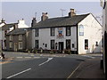
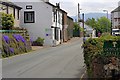
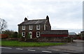
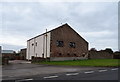
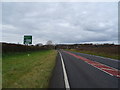
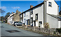
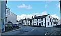
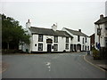
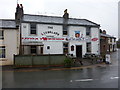
Gosforth, a built-up area in England covering 43.2 hectares, offers a distinct blend of residential living with a strong sense of community. The area’s median age of 70 suggests a population skewed towards older residents, which shapes the local character. With 81% of homes owner-occupied, Gosforth is a stable, long-term community where many residents have lived for years. Daily life is supported by nearby amenities, including five retail outlets like Budgens Gosforth and Co-op Seascale, as well as multiple rail and metro stations, such as Seascale Railway Station and Miteside. The area’s safety is a key draw, with a crime risk score of 74, reflecting below-average rates. While broadband connectivity is rated poorly at 27, mobile coverage is strong at 80, ensuring reliable communication for most needs. For families, Gosforth CofE Primary School, rated ‘good’ by Ofsted, is a local anchor. This area suits those seeking a settled lifestyle with practical access to transport, shops, and education.
- Area Type
- Built Up Area 250
- Area Size
- 43.2 hectares
- Population
- Not available
- Population Density
- Not available
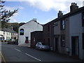
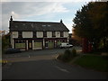
Gosforth’s lifestyle is shaped by its accessible amenities, including five retail outlets like Budgens Gosforth and Spar, offering everyday shopping convenience. The presence of multiple rail and metro stations, such as Sellafield and Murthwaite, ensures easy access to nearby towns and services. While the data does not specify parks or leisure facilities, the area’s practical connectivity suggests residents can reach recreational areas in the surrounding region. The community feel is reinforced by the stability of long-term residents and the low crime risk, creating an environment where daily life is predictable and secure. The mix of retail, transport, and educational options makes Gosforth a functional base for those prioritising practicality over urban amenities.
Amenities
Schools
The primary school near Gosforth is Gosforth CofE Primary School, which holds a ‘good’ Ofsted rating. This institution serves the local community, offering education for younger children in a setting that aligns with the area’s demographic profile. While no secondary schools are listed in the data, the presence of a well-rated primary school suggests that families with young children may find the area suitable. The single primary school available means parents must consider its capacity and proximity to their homes. For those prioritising education quality, the ‘good’ rating indicates a reliable standard of teaching and facilities. However, the absence of further educational institutions may require families to look beyond Gosforth for secondary schooling.
| Rank | School | Type | Entry gender | Ages |
|---|
Explore more schools in this area
Go to Schools tabDemographics
Gosforth’s population is predominantly older, with a median age of 70, indicating a community where many residents are retired or in later life. The home ownership rate of 81% underscores a stable residential base, with most households owning their properties. Data on household composition and accommodation types is not specified, but the high home ownership suggests a mix of family homes and single-occupancy properties. The area’s demographic profile is not detailed in terms of ethnic or religious diversity, but the overall population is likely to reflect broader regional trends. The age profile means services and amenities are tailored to older residents, with a focus on accessibility and low-maintenance living. While the data does not quantify deprivation, the safety and connectivity suggest a quality of life that prioritises stability over urban vibrancy.
Household Size
Accommodation Type
Tenure
Ethnic Group
Religion
Household Composition
Age
Household Deprivation
NS-SEC
Explore more demographic insights in this area
Go to Demographics tabPlanning
Planning Constraints
- Crime RiskPremium