Area Overview for Gilcrux
Photos of Gilcrux
Area Information
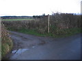
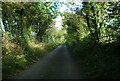
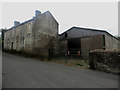
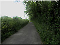
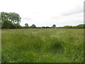
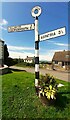
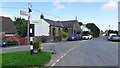
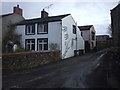
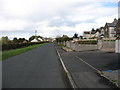
Living in Gilcrux offers a distinct experience within the Allerdale district of Cumbria. This civil parish covers an area of 8.2 square kilometres and sits approximately five miles north-east of Cockermouth. The location places residents close to the Solway Coast while maintaining a rural setting. Your daily life will reflect the history of this place, which counts back to the 16th century. Christopher Saxton's 1567 map first recorded the location then known as Gilcrosse. The name itself hints at Celtic origins, a heritage visible in the local church. St Mary's Church stands as a Norman-era structure from circa AD 1100. It features Anglo-Saxon influences and a Viking cross fragment dating to circa AD 980. The church underwent significant changes over time. The roofs altered in the 17th century, the structure reslated by 1703, and a bell-cote added in 1794. A vestry joined the building in 1888. Homes in Gilcrux provide access to historic landmarks beyond the church. You can find the 1836 sundial and the 1759 Royal Arms of George II on site. Nearby, the Moorforge Viking Settlement offers connections to local history through reenactments. First recorded settlements here attract Anglo-Saxon and Viking settlers from around AD 600 onwards. The manor was granted to Calder Abbey in the mid-13th century. By 1632 it passed to the Dykes family. This deep historical context shapes the character of the community. The landscape remains largely defined by its past. No major planning constraints like protected woodlands or AONB status limit current development. This balance of history and openness defines the area today.
- Area Type
- Parish
- Area Size
- 8.2 km²
- Population
- Not available
- Population Density
- Not available
Demographics
The community in Gilcrux reflects a settled, mature population. The median age stands at 70 years old. Most residents fall into the older age bracket, indicating a neighbourhood where life moves at a slower pace. This demographic profile suggests a quiet environment rather than a bustling hub for young families or students. Eighty-two per cent of households own their homes. This high level of ownership shows deep roots within the parish. Very few people rent locally, stabilising the community structure. You will find a consistent population living in the same houses for generations. The area accommodates a modest number of households spread across 8.2 square kilometres. Ethnic diversity, religious breakdown, and specific household composition statistics are not detailed in the available records. This lack of granular diversity data points toward a homogenous community. Residents likely share similar backgrounds and lifestyles. The overall picture is one of stability. With a median age of 70, services might cater primarily to the needs of older adults. Local shops and amenities would reflect this reality. The high home ownership rate of 82 per cent means property values tend to remain relatively stable. Families or young professionals moving here may find the demographic less geared toward child-rearing. Instead, they join a community defined by long-term residence and a deep connection to the local history surrounding St Mary's Church and the surrounding moors.
Household Size
Accommodation Type
Tenure
Ethnic Group
Religion
Household Composition
Age
Household Deprivation
NS-SEC
Explore more demographic insights in this area
Go to Demographics tabPlanning
Planning Constraints
- Flood RiskPremium
- Ramsar Wetland SitesPremium
- Area of Outstanding Natural BeautyPremium
- Protected Nature ReservePremium
- Protected WoodlandPremium
- Crime RiskPremium