Area Overview for Gatley
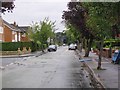
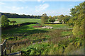
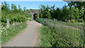
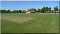
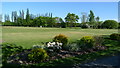
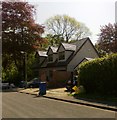
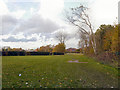
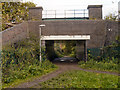
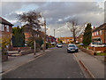
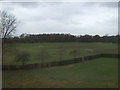
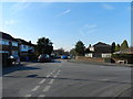
Photos of Gatley
Area Information
Gatley, a built-up area in England covering 2.4 km², offers a compact yet functional living environment. With a median age of 70, the community is predominantly older, shaping a distinct social dynamic. The area’s home ownership rate of 73% suggests a stable, long-term resident base. Daily life in Gatley is supported by nearby schools, including Gatley Primary School and The Kingsway County Secondary School, ensuring educational continuity for families. Retail options like Tesco Gatley and Co-op Gatley provide essential shopping, while rail links to Gatley Railway Station and Heald Green Railway Station connect residents to broader networks. Despite its size, Gatley’s proximity to airports and metro points like Benchill and Crossacres enhances mobility. However, the area’s safety profile is a concern, with a critical crime risk rating. For those prioritising convenience and connectivity, Gatley balances practicality with the challenges of its demographic and safety landscape.
- Area Type
- Built Up Area 250
- Area Size
- 2.4 km²
- Population
- Not available
- Population Density
- Not available
Gatley’s lifestyle is shaped by its proximity to practical amenities. Retail options include Tesco Gatley, Co-op Gatley, and Morrisons Daily Wythenshawe, ensuring accessible shopping for essentials. The rail network connects residents to nearby towns, while metro points like Peel Hall offer alternative transport routes. Airports within reach, such as Terminal One Access, cater to travel needs. Though the area lacks detailed information on parks or leisure facilities, the presence of multiple retail and transport hubs suggests a focus on convenience over recreational spaces. Daily life in Gatley is efficient, with amenities designed for practicality rather than leisure, reflecting the community’s older demographic and functional priorities.
Amenities
Schools
Gatley’s schools include Gatley Primary School, Lum Head Primary School (rated good by Ofsted), North Cheshire Jewish Primary School (also good), The Kingsway School, and The Kingsway County Secondary School. This mix of primary and secondary institutions provides a comprehensive educational pathway for families. The presence of two primary schools with good Ofsted ratings offers reassurance for parents seeking quality early education. The secondary school, The Kingsway County Secondary School, ensures continuity for students transitioning from primary to secondary education. The range of options caters to both local and specialist needs, though the absence of data on school capacity or catchment areas means prospective families should verify eligibility.
| Rank | School | Type | Entry gender | Ages |
|---|
Explore more schools in this area
Go to Schools tabDemographics
Gatley’s population is defined by a median age of 70, the highest in the dataset, indicating a community skewed towards older adults. Home ownership stands at 73%, reflecting a strong presence of long-term residents. While the data does not specify household composition or ethnic diversity, the overall figures suggest a relatively homogeneous demographic. The age profile may influence local services and amenities, with healthcare and retirement-focused facilities likely playing a central role. The absence of detailed diversity metrics means the area’s cultural and social mix remains unquantified. For prospective buyers, the older population may signal a quieter, less dynamic environment compared to areas with younger demographics.
Household Size
Accommodation Type
Tenure
Ethnic Group
Religion
Household Composition
Age
Household Deprivation
NS-SEC
Explore more demographic insights in this area
Go to Demographics tabPlanning
Planning Constraints
- Crime RiskPremium