Area Overview for Garston Ward
Photos of Garston Ward


Area Information
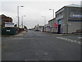
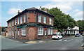
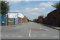
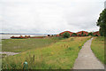
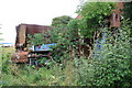
Garston Ward sits approximately 5.5 miles south of Liverpool city centre, bordered by Aigburth, Grassendale, Allerton, and Speke. Located on the River Mersey, this 8.8 km² district is part of Liverpool in Merseyside, though historically it belonged to Lancashire. The area spans a relatively compact footprint that supports a population of 6,246 residents. You will find yourself in a district where history intersects with modern living, from its roots as a medieval grazing settlement known as Gaerstun to its rapid growth during the 1840s when dock openings attracted Irish migrants. Notable local landmarks include St Michael’s Church and Seafield Cottages, which date back to the 1730s. The neighbourhood also features shopping streets on St Mary's Road and Woolton Road, alongside the historic 'Garston-Under-The-Bridge' area. Former industrial sites, such as match factories once operated by Bryant and May, reflect the area's evolution from a monastic grange settlement to a residential district. Homes in Garston Ward offer proximity to both natural waterways and established urban infrastructure, defining a specific place within the wider Liverpool region for those seeking a community with deep historical roots.
- Area Type
- District Borough Unitary Ward
- Area Size
- 8.8 km²
- Population
- 6246
- Population Density
- 709 people/km²
Demographics
The community in Garston Ward is defined by a distinctly mature age profile, with a median age of 70. This demographic concentration indicates that the area appeals more to retirees than families with young children or recent professionals. While specific details on household composition and predominant ethnic groups are not quantified in the available records, the age data paints a clear picture of who resides here. The area hosts 60% rented properties, with only 50% of households owning their homes. This split suggests a mixed tenure landscape where renting remains a common living arrangement alongside substantial owner-occupation. Accommodation types vary across the ward, though the high proportion of rentals may point toward leasehold arrangements or properties maintained for older residents. Living in Garston Ward means sharing the neighbourhood primarily with an older demographic, which often correlates with quieter streets and a different pace of life compared to younger districts. You are buying or renting into a community where the most common age range spans the older decades, shaping social interactions and local demand for services like healthcare rather than schools.
Household Size
Accommodation Type
Tenure
Ethnic Group
Religion
Household Composition
Age
Household Deprivation
NS-SEC
Explore more demographic insights in this area
Go to Demographics tabPlanning
Planning Constraints
- Flood RiskPremium
- Ramsar Wetland SitesPremium
- Area of Outstanding Natural BeautyPremium
- Protected Nature ReservePremium
- Protected WoodlandPremium
- Crime RiskPremium