Area Overview for FY8 5PP
Photos of FY8 5PP
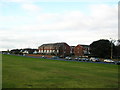


44 photos from this area
Area Information
Key information about the FY8 5PP including its size, population, and administrative classification.
- Area Type
- Postcode
- Area Size
- 20.1 hectares
- Population
- 1351
- Population Density
- 2260 people/km²
House Prices in FY8 5PP
23
Properties
£897,500
Average Sold Price
£500,000
Lowest Price
£1,295,000
Highest Price
Showing 23 properties
| Address | Type | Beds | Baths | Last Sale Price | Last Sale Date | |
|---|---|---|---|---|---|---|
| Carlton Lawns, 1A Clifton Drive, Lytham St Annes, FY8 5PP | house | 5 | - | £1,295,000 | Mar 2022 | |
| 4A Clifton Drive, Lytham St Annes, FY8 5PP | house | - | - | £500,000 | Feb 2020 | |
| Elm Lodge, 4 Clifton Drive, Lytham St Annes, FY8 5PP | Detached | 3 | 3 | - | - | |
| The Elms, 4 Clifton Drive, Lytham St Annes, FY8 5PP | Detached | 5 | 5 | - | - | |
| Fairlawn Cottage, Clifton Drive, Lytham St Annes, FY8 5PP | undefined | - | - | - | - | |
| Ground Floor Flat, Heaton Grange, 1 Clifton Drive, Lytham St Annes, FY8 5PP | Flat | - | - | - | - | |
| First Floor Flat, Heaton Grange, 1 Clifton Drive, Lytham St Annes, FY8 5PP | Flat | - | - | - | - | |
| Second Floor Flat, Heaton Grange, 1 Clifton Drive, Lytham St Annes, FY8 5PP | Flat | - | - | - | - | |
| Beachwood, 2B Clifton Drive, Lytham St Annes, FY8 5PP | Detached | - | - | - | - | |
| Mews Cottage, 2A Clifton Drive, Lytham St Annes, FY8 5PP | Terraced | - | - | - | - |
Page 1 of 3
Energy Efficiency in FY8 5PP
Amenities
Schools
| Rank | School | Type | Entry gender | Ages |
|---|
Explore more schools in this area
Go to Schools tabDemographics
Household Size
One person
most common
Accommodation Type
Flats
most common
Tenure
68
majority
Ethnic Group
White
most common
Religion
N/A
most common
Household Composition
N/A
most common
Age
47
median
Elderly (65+ years)
most common
Household Deprivation
N/A
with no deprivation
NS-SEC
43
in Lower managerial occupations
Explore more demographic insights in this area
Go to Demographics tabPlanning
Planning Constraints
- Flood RiskPremium
- Ramsar Wetland SitesPremium
- Area of Outstanding Natural BeautyPremium
- Protected Nature ReservePremium
- Protected WoodlandPremium