Area Overview for FY8 5DB
Photos of FY8 5DB
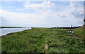

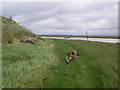
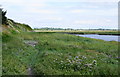

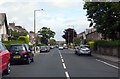


100 photos from this area
Area Information
Key information about the FY8 5DB including its size, population, and administrative classification.
- Area Type
- Postcode
- Area Size
- 1.1 hectares
- Population
- 1871
- Population Density
- 2452 people/km²
House Prices in FY8 5DB
29
Properties
£218,249
Average Sold Price
£72,000
Lowest Price
£386,000
Highest Price
Showing 29 properties
| Address | Type | Beds | Baths | Last Sale Price | Last Sale Date | |
|---|---|---|---|---|---|---|
| 55 Victoria Street, Lytham St Annes, FY8 5DB | house | 3 | 1 | £386,000 | Jan 2024 | |
| 71 Victoria Street, Lytham St Annes, FY8 5DB | Semi-detached | 3 | 1 | £210,000 | Jul 2023 | |
| 61 Victoria Street, Lytham St Annes, FY8 5DB | house | - | - | £330,000 | Mar 2023 | |
| 65 Victoria Street, Lytham St Annes, FY8 5DB | Detached | 3 | 2 | £279,995 | Oct 2022 | |
| 50 Victoria Street, Lytham St Annes, FY8 5DB | Terraced | 4 | 3 | £285,000 | Mar 2018 | |
| 53 Victoria Street, Lytham St Annes, FY8 5DB | house | - | - | £208,000 | Apr 2017 | |
| 44 Victoria Street, Lytham St Annes, FY8 5DB | Terraced | 3 | - | £237,500 | Mar 2015 | |
| 73 Victoria Street, Lytham St Annes, FY8 5DB | Semi-detached | - | - | £195,000 | Jan 2014 | |
| 45 Victoria Street, Lytham St Annes, FY8 5DB | house | - | - | £150,000 | Jul 2012 | |
| 57 Victoria Street, Lytham St Annes, FY8 5DB | house | - | - | £232,000 | Aug 2009 |
Page 1 of 3
Energy Efficiency in FY8 5DB
Amenities
Schools
| Rank | School | Type | Entry gender | Ages |
|---|
Explore more schools in this area
Go to Schools tabDemographics
Household Size
Two person
most common
Accommodation Type
Houses
most common
Tenure
74
majority
Ethnic Group
White
most common
Religion
N/A
most common
Household Composition
N/A
most common
Age
47
median
Adults (30-64 years)
most common
Household Deprivation
N/A
with no deprivation
NS-SEC
45
in Lower managerial occupations
Explore more demographic insights in this area
Go to Demographics tabPlanning
Planning Constraints
- Flood RiskPremium
- Ramsar Wetland SitesPremium
- Area of Outstanding Natural BeautyPremium
- Protected Nature ReservePremium
- Protected WoodlandPremium