Area Overview for FY8 3DJ
Photos of FY8 3DJ

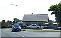
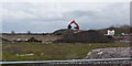
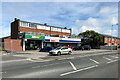
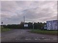
16 photos from this area
Area Information
Key information about the FY8 3DJ including its size, population, and administrative classification.
- Area Type
- Postcode
- Area Size
- 2.2 hectares
- Population
- 1228
- Population Density
- 1250 people/km²
House Prices in FY8 3DJ
40
Properties
£99,610
Average Sold Price
£22,200
Lowest Price
£175,000
Highest Price
Showing 40 properties
| Address | Type | Beds | Baths | Last Sale Price | Last Sale Date | |
|---|---|---|---|---|---|---|
| 52 Walter Avenue, Lytham St Annes, FY8 3DJ | house | 3 | 1 | £165,000 | Jun 2024 | |
| 82 Walter Avenue, Lytham St Annes, FY8 3DJ | house | 3 | 1 | £175,000 | Jan 2023 | |
| 40 Walter Avenue, Lytham St Annes, FY8 3DJ | house | 3 | - | £154,000 | Nov 2022 | |
| 32 Walter Avenue, Lytham St Annes, FY8 3DJ | Terraced | 3 | 1 | £120,000 | Jun 2022 | |
| 2 Walter Avenue, Lytham St Annes, FY8 3DJ | Semi-detached | 3 | 1 | £124,000 | Sep 2018 | |
| 42 Walter Avenue, Lytham St Annes, FY8 3DJ | house | - | - | £119,000 | Jul 2018 | |
| 60 Walter Avenue, Lytham St Annes, FY8 3DJ | house | - | - | £110,000 | Jan 2016 | |
| 76 Walter Avenue, Lytham St Annes, FY8 3DJ | Terraced | 3 | - | £84,000 | Oct 2013 | |
| 74 Walter Avenue, Lytham St Annes, FY8 3DJ | Terraced | 3 | - | £85,000 | Jan 2013 | |
| 78 Walter Avenue, Lytham St Annes, FY8 3DJ | house | 3 | - | £92,000 | Aug 2012 |
Page 1 of 4
Energy Efficiency in FY8 3DJ
Amenities
Schools
| Rank | School | Type | Entry gender | Ages |
|---|
Explore more schools in this area
Go to Schools tabDemographics
Household Size
One person
most common
Accommodation Type
Houses
most common
Tenure
42
majority
Ethnic Group
White
most common
Religion
N/A
most common
Household Composition
N/A
most common
Age
47
median
Adults (30-64 years)
most common
Household Deprivation
N/A
with no deprivation
NS-SEC
21
in Lower managerial occupations
Explore more demographic insights in this area
Go to Demographics tabPlanning
Planning Constraints
- Flood RiskPremium
- Ramsar Wetland SitesPremium
- Area of Outstanding Natural BeautyPremium
- Protected Nature ReservePremium
- Protected WoodlandPremium