Area Overview for FY8 2DH
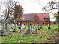
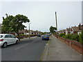
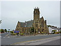
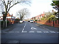
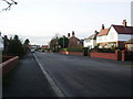
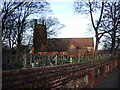
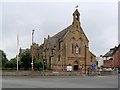
Photos of FY8 2DH


Area Information
Living in FY8 2DH means inhabiting a tightly packed residential cluster in England, where 1,610 people reside across just 5,949 square metres. This density creates a compact, closely knit community, though it also means limited space for expansion. The area’s small size and high population density shape daily life, with residents relying heavily on nearby amenities and transport links. FY8 2DH is not a sprawling suburb but a focused cluster of homes, primarily flats, which dominate the housing stock. The median age of 47 suggests a mature population, with adults aged 30–64 forming the largest group. This demographic likely influences the area’s quiet, settled character, though the high population density may impact personal space and local services. Despite its size, FY8 2DH is connected to broader networks—rail, road, and digital—making it a practical base for those prioritising convenience over isolation. However, its small footprint means every decision about living here, from schools to safety, is shaped by proximity and local constraints.
- Area Type
- Postcode
- Area Size
- 5949 m²
- Population
- 1610
- Population Density
- 1951 people/km²
The property market in FY8 2DH is defined by its high density and reliance on flats. With 48% of homes owner-occupied, the area is not dominated by long-term residents but rather a mix of renters and owners. The prevalence of flats suggests a focus on compact, efficient living, which may appeal to those prioritising affordability or proximity to transport. However, the small size of the area—just 5,949 square metres—means the housing stock is limited, and the immediate surroundings may offer little in the way of alternative options. This compactness could make the market competitive, particularly for buyers seeking larger properties or more space. For those considering homes in FY8 2DH, the flat-dominated landscape means expectations should align with urban living rather than suburban spread. The high population density also implies that any property here is likely to be part of a tightly packed cluster, with little room for expansion or redevelopment.
House Prices in FY8 2DH
No properties found in this postcode.
Energy Efficiency in FY8 2DH
Life in FY8 2DH is shaped by its proximity to a range of amenities, from retail to transport. Five retail outlets, including Sainsburys Lytham and Tesco St Anne’s, provide everyday shopping needs, while Aldi St offers additional options for groceries. The area’s rail network, with stations like St Annes and Ansdell & Fairhaven, connects residents to broader destinations, and the nearby Blackpool International Airport ensures easy travel. Five metro stops, such as Burlington Road West, and the Central Coach Station enhance mobility further. Though the data does not list parks or leisure facilities explicitly, the presence of multiple transport hubs and retail options suggests a focus on convenience over expansive recreational spaces. The compact nature of FY8 2DH means amenities are accessible without long commutes, though the limited variety of venues may require residents to venture slightly further for specialised services like dining or entertainment.
Amenities
Schools
The nearest school to FY8 2DH is Red Rose School, a special school with an Ofsted rating of satisfactory. This indicates the area is served by a facility catering to students with specific educational needs, though no other schools are listed in the data. Families requiring mainstream education for their children may need to look beyond the immediate vicinity, as the absence of primary or secondary schools in the area suggests limited options for general schooling. The presence of a special school could be a key factor for families with children requiring tailored support, but it does not address broader educational needs. The Ofsted rating of satisfactory means the school meets basic standards, but there is no indication of outstanding performance or additional resources. For those prioritising a range of school types, FY8 2DH’s current offerings may not be sufficient without commuting to nearby towns.
| Rank | School | Type | Entry gender | Ages |
|---|
Explore more schools in this area
Go to Schools tabDemographics
The community in FY8 2DH is predominantly composed of adults aged 30–64, with a median age of 47. This suggests a population focused on stability, likely including families, professionals, and retirees. Home ownership rates stand at 48%, meaning nearly half of residents rent their homes. The accommodation type is exclusively flats, indicating a lack of detached or semi-detached housing. The predominant ethnic group is White, though no data is provided on other ethnicities or diversity metrics. The high population density—270,650 people per square kilometre—means living spaces are closely packed, which can affect privacy and community dynamics. While this density may foster a sense of neighbourliness, it also raises practical challenges, such as limited green space or pressure on local services. The age profile suggests a balance between working-age adults and older residents, but the absence of specific data on family structures or deprivation levels means the area’s social fabric remains partially opaque.
Household Size
Accommodation Type
Tenure
Ethnic Group
Religion
Household Composition
Age
Household Deprivation
NS-SEC
Explore more demographic insights in this area
Go to Demographics tabPlanning
Planning Constraints
- Flood RiskPremium
- Ramsar Wetland SitesPremium
- Area of Outstanding Natural BeautyPremium
- Protected Nature ReservePremium
- Protected WoodlandPremium