Area Overview for FY8 1SU
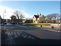
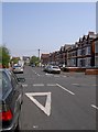
Photos of FY8 1SU


Area Information
Living in FY8 1SU means being part of a small, tightly knit residential cluster in England, home to 1,337 people. This postcode area is characterised by its compact size and proximity to key transport links, making it a practical choice for those seeking convenience. The community is predominantly middle-aged, with adults aged 30–64 forming the largest demographic group. While the area’s housing stock is primarily flats, the low home ownership rate of 29% suggests a rental market that caters to a transient or younger population. Despite its small footprint, FY8 1SU offers access to essential amenities, including multiple railway stations, retail outlets, and nearby airports. However, residents should be aware of the area’s high crime risk, which requires attention to security. For those prioritising connectivity and accessibility, FY8 1SU provides a blend of urban convenience and suburban quiet, though its small size means limited expansion. The area’s appeal lies in its practicality, with daily life shaped by its proximity to transport hubs and retail centres, though its safety profile demands careful consideration.
- Area Type
- Postcode
- Area Size
- Not available
- Population
- 1337
- Population Density
- Not available
The property market in FY8 1SU is defined by its low home ownership rate of 29%, which points to a rental-dominated landscape. The majority of accommodation is flats, a common feature in smaller residential clusters where space is constrained. This suggests a market that prioritises efficiency over expansive living, catering to individuals or families seeking affordable, manageable housing. For buyers, the area’s small size means limited options, with flats being the primary available format. The rental focus may indicate that property values are more stable than in owner-occupied areas, but it also means competition for purchase opportunities is likely to be fierce. The predominance of flats could also mean that the area lacks larger homes or detached properties, which may be a drawback for those seeking more space. Given the low home ownership, prospective buyers should consider whether the rental market’s dynamics align with their long-term goals, as the area’s property stock is unlikely to expand significantly.
House Prices in FY8 1SU
Showing 1 properties
| Address | Type | Beds | Baths | Last Sale Price | Last Sale Date | |
|---|---|---|---|---|---|---|
| Station Bridge Works, St Andrews Road South, Lytham St Annes, FY8 1SU | Industrial | - | - | - | - |
Energy Efficiency in FY8 1SU
Life in FY8 1SU is shaped by its proximity to a range of amenities that cater to daily needs. The area is within walking or short-vehicle distance of major retailers like Sainsburys Lytham, Tesco St Anne’s, and M&S Lytham St Annes, ensuring easy access to groceries, clothing, and other essentials. For travel, five railway stations and five metro stops provide frequent connections to nearby towns, while Blackpool International Airport offers regional and international flight options. The presence of Central Coach Station adds flexibility for longer journeys. The compact nature of the area means that residents can access these services without lengthy commutes, though the limited number of amenities suggests a focus on convenience over variety. The mix of retail, transport, and travel infrastructure creates a practical lifestyle, where daily errands and travel are efficiently managed. However, the small scale of the area may mean that more niche or specialist services are not readily available.
Amenities
Schools
| Rank | School | Type | Entry gender | Ages |
|---|
Explore more schools in this area
Go to Schools tabDemographics
FY8 1SU has a median age of 47, with the majority of residents falling within the 30–64 age range. This suggests a community skewed towards middle-aged adults, likely with established careers and families. Home ownership is relatively low at 29%, indicating that a significant portion of the population rents their homes. The accommodation type is predominantly flats, reflecting a compact, possibly urban or semi-urban setting. The predominant ethnic group is White, though no specific data on diversity or deprivation levels is provided. The low home ownership rate may imply a transient population or a focus on rental properties, which could influence the local economy and social dynamics. With a population of 1,337, the area is small enough to foster a close-knit community but limited in scale to offer a wide range of services. The demographic profile suggests a stable, mature population, though the absence of detailed diversity metrics means the full picture of the community’s composition remains partially obscured.
Household Size
Accommodation Type
Tenure
Ethnic Group
Religion
Household Composition
Age
Household Deprivation
NS-SEC
Explore more demographic insights in this area
Go to Demographics tabPlanning
Planning Constraints
- Flood RiskPremium
- Ramsar Wetland SitesPremium
- Area of Outstanding Natural BeautyPremium
- Protected Nature ReservePremium
- Protected WoodlandPremium