Area Overview for FY8 1NS
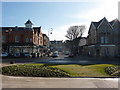
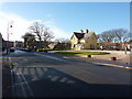
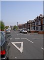
Photos of FY8 1NS


Area Information
Living in FY8 1NS offers a compact, residential experience shaped by its small cluster of homes and proximity to essential services. With a population of 1,575, the area is not densely populated, creating a quiet, community-focused atmosphere. The postcode sits in a region where older residents form the majority, with a median age of 47 and the elderly (65+) being the most common age group. This suggests a settled, mature demographic, likely with established routines and a focus on local amenities. The area’s housing stock is dominated by flats, reflecting a mix of owner-occupied and rental properties. While the population is modest, the presence of nearby schools, rail links, and retail options ensures daily life remains convenient. Residents benefit from proximity to St Annes and other nearby railway stations, making commuting manageable. The area’s small size means it is not a sprawling suburb, but its accessibility to larger towns via transport networks adds to its practical appeal. For those seeking a low-key, service-rich environment, FY8 1NS provides a balance of simplicity and connectivity.
- Area Type
- Postcode
- Area Size
- Not available
- Population
- 1575
- Population Density
- Not available
The property market in FY8 1NS is characterised by a high proportion of flats and a moderate level of home ownership. With 58% of properties owner-occupied, the area is not dominated by a rental market but reflects a mix of private and rented homes. The prevalence of flats suggests a focus on compact, low-maintenance housing, which may appeal to older residents or those prioritising ease of maintenance. Given the postcode’s small size, the housing stock is limited, meaning buyers may need to consider nearby areas for more options. The flat-dominated market could also indicate a lack of larger family homes, which might be a consideration for growing households. However, the presence of multiple rail stations and proximity to retail hubs like M&S Lytham St Annes and Tesco St Anne’s adds to the area’s practicality. For buyers, the challenge lies in the limited supply, but the existing properties offer a straightforward, no-frills living option for those seeking affordability and convenience.
House Prices in FY8 1NS
No properties found in this postcode.
Energy Efficiency in FY8 1NS
The lifestyle in FY8 1NS is shaped by its proximity to retail, transport, and leisure facilities. Residents have access to five retail outlets, including M&S Lytham St Annes, Tesco St Anne’s, and Aldi St, ensuring everyday shopping needs are met. The area’s transport links are extensive, with five rail stations, five metro stops, and two airports nearby. This makes commuting and travel convenient, though the single bus stop at Central Coach Station may limit public transport options. While the data does not specify parks or leisure venues, the presence of multiple retail and transport hubs suggests a practical, service-oriented lifestyle. The area is not a destination for cultural or recreational activities, but its accessibility to larger towns via rail and metro means residents can easily access more diverse amenities elsewhere. For those prioritising convenience over leisure, FY8 1NS offers a straightforward, functional living environment with minimal need for long-distance travel.
Amenities
Schools
Residents of FY8 1NS have access to two independent schools: St Anne’s College Grammar School and Clifton Tutorial Centre. St Anne’s College Grammar School has an Ofsted rating of satisfactory, while Clifton Tutorial Centre is also independent but lacks an Ofsted rating in the data. The presence of two independent schools suggests the area caters to families prioritising private education, though the quality of Clifton Tutorial Centre remains unspecified. Independent schools often offer smaller class sizes and specialised curricula, which can be advantageous for parents seeking tailored education. However, the lack of state school options means families must rely on private institutions, which may come with higher costs. For those valuing school choice, the availability of two independent schools is a key feature, but prospective buyers should consider the financial implications and the specific offerings of each institution.
| Rank | School | Type | Entry gender | Ages |
|---|
Explore more schools in this area
Go to Schools tabDemographics
The community in FY8 1NS is defined by its age profile, with the elderly (65+) making up the largest share of the population. This aligns with the median age of 47, indicating a population skewed toward older residents. Home ownership stands at 58%, meaning nearly half of properties are owner-occupied, while the remaining 42% are likely rentals. The accommodation type is predominantly flats, which is unusual for a small postcode but suggests a focus on purpose-built housing or converted buildings. The predominant ethnic group is White, reflecting a homogenous demographic. This mix of older residents and flats may influence local services, such as healthcare and community centres. While deprivation data is not provided, the presence of multiple retail outlets and transport links suggests basic needs are met. The area’s demographic profile indicates a stable, low-turnover community, which can be appealing for those seeking a consistent, familiar environment.
Household Size
Accommodation Type
Tenure
Ethnic Group
Religion
Household Composition
Age
Household Deprivation
NS-SEC
Explore more demographic insights in this area
Go to Demographics tabPlanning
Planning Constraints
- Flood RiskPremium
- Ramsar Wetland SitesPremium
- Area of Outstanding Natural BeautyPremium
- Protected Nature ReservePremium
- Protected WoodlandPremium