Area Overview for FY8 1NN
Photos of FY8 1NN
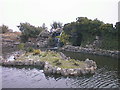


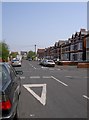


100 photos from this area
Area Information
Key information about the FY8 1NN including its size, population, and administrative classification.
- Area Type
- Postcode
- Area Size
- 1.8 hectares
- Population
- 1575
- Population Density
- 3287 people/km²
House Prices in FY8 1NN
74
Properties
£300,525
Average Sold Price
£70,000
Lowest Price
£495,000
Highest Price
Showing 74 properties
| Address | Type | Beds | Baths | Last Sale Price | Last Sale Date | |
|---|---|---|---|---|---|---|
| 11 Fairhaven Road, Lytham St Annes, FY8 1NN | Semi-detached | 6 | 4 | £285,000 | Jul 2024 | |
| 19 Fairhaven Road, Lytham St Annes, FY8 1NN | Flat | 1 | - | £355,000 | Apr 2023 | |
| 20 Fairhaven Road, Lytham St Annes, FY8 1NN | Detached | - | - | £174,750 | Sep 2009 | |
| 10 Fairhaven Road, Lytham St Annes, FY8 1NN | Flat | 2 | - | £335,000 | Jun 2009 | |
| 11A Fairhaven Road, Lytham St Annes, FY8 1NN | house | - | - | £420,000 | Mar 2008 | |
| 16 Fairhaven Road, Lytham St Annes, FY8 1NN | house | 4 | 4 | £427,500 | Nov 2005 | |
| Fairhaven Lodge Rest Home, 7-T-9 Fairhaven Road, Lytham St Annes, FY8 1NN | Retirement | - | - | £495,000 | Jul 2005 | |
| 14 Fairhaven Road, Lytham St Annes, FY8 1NN | Detached | - | - | £365,000 | Jun 2004 | |
| 18 Fairhaven Road, Lytham St Annes, FY8 1NN | Semi-detached | - | - | £70,000 | Feb 2004 | |
| 35 Fairhaven Road, Lytham St Annes, FY8 1NN | Semi-detached | - | - | £78,000 | Feb 1999 |
Page 1 of 8
Energy Efficiency in FY8 1NN
Amenities
Schools
| Rank | School | Type | Entry gender | Ages |
|---|
Explore more schools in this area
Go to Schools tabDemographics
Household Size
One person
most common
Accommodation Type
Flats
most common
Tenure
58
majority
Ethnic Group
White
most common
Religion
N/A
most common
Household Composition
N/A
most common
Age
47
median
Elderly (65+ years)
most common
Household Deprivation
N/A
with no deprivation
NS-SEC
35
in Lower managerial occupations
Explore more demographic insights in this area
Go to Demographics tabPlanning
Planning Constraints
- Flood RiskPremium
- Ramsar Wetland SitesPremium
- Area of Outstanding Natural BeautyPremium
- Protected Nature ReservePremium
- Protected WoodlandPremium