Area Overview for FY8 1DS
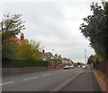
Photos of FY8 1DS


Area Information
Living in FY8 1DS offers a quiet, compact residential experience in a small cluster of homes. With a population of 1,559, the area is characterised by a mature community, where the median age of 47 suggests a stable demographic of adults aged 30–64. This is a place where homeownership is prevalent, with 80% of properties owned by residents, and housing stock primarily consists of individual houses rather than flats. The area’s small size means daily life is centred around nearby amenities, including independent schools, rail stations, and retail outlets. While it lacks the density of larger towns, FY8 1DS provides a low-maintenance lifestyle with minimal urban pressures. Its proximity to Blackpool International Airport and Warton Airport, combined with rail links to Ansdell & Fairhaven and Lytham stations, ensures connectivity to broader regional networks. The absence of environmental constraints like AONB or protected woodlands means development restrictions are minimal, though the area’s safety profile—marked by a crime risk score of 91—adds to its appeal. For buyers seeking a low-risk, owner-occupied community with practical infrastructure, FY8 1DS presents a focused option.
- Area Type
- Postcode
- Area Size
- Not available
- Population
- 1559
- Population Density
- Not available
The property market in FY8 1DS is dominated by owner-occupied homes, with 80% of properties in private hands. This contrasts with areas where rental demand drives market dynamics, suggesting a more stable, long-term resident base. The accommodation type is predominantly houses, which aligns with the area’s small, residential character. This focus on single-family homes may appeal to buyers seeking space and privacy, though the limited scale of the area means housing stock is unlikely to expand significantly. The high home ownership rate indicates strong community retention, potentially reducing turnover and competition for properties. For buyers, this means a market where properties are likely to remain in the same hands for extended periods, with fewer speculative investments. The absence of flats or larger developments means the area is not suited to those prioritising rental yields or high-density living.
House Prices in FY8 1DS
No properties found in this postcode.
Energy Efficiency in FY8 1DS
Residents of FY8 1DS have access to a modest but functional array of amenities. Retail options include Spar, Co-op Woodlands, and M&S Lytham St Annes, providing essentials and everyday shopping. The area’s rail stations, including Ansdell & Fairhaven and Lytham, offer regular services to nearby towns, while nearby airports provide regional travel opportunities. For leisure, the proximity to Starr Gate, Harrow Place, and Burlington Road West metro stops may connect to local attractions, though specifics are not detailed. The absence of parks or recreational spaces is notable, but the area’s compact size ensures amenities are within walking or short driving distance. This balance of retail, transport, and connectivity supports a practical lifestyle, ideal for those prioritising convenience over expansive leisure options.
Amenities
Schools
The nearest school to FY8 1DS is Queen Mary School, an independent institution. While no Ofsted rating is provided, the presence of an independent school suggests a focus on private education options for families. This contrasts with areas where state schools dominate, offering a mix of public and private educational choices. For parents prioritising independent schooling, Queen Mary School provides a dedicated option, though its specific academic performance or facilities are not detailed. The area’s small size means families may need to travel to access additional schools, but the presence of one independent institution indicates a niche appeal for those seeking non-state education.
| Rank | School | Type | Entry gender | Ages |
|---|
Explore more schools in this area
Go to Schools tabDemographics
The community in FY8 1DS is predominantly composed of adults aged 30–64, reflecting a median age of 47. This suggests a mature population, likely with established careers and families. Homeownership is high, with 80% of residents owning their homes, indicating a stable housing market. The area’s accommodation is largely houses, which aligns with the demographic profile of older, settled households. The predominant ethnic group is White, though no specific data on diversity or deprivation is provided. The absence of detailed breakdowns on household types or income levels means the community’s socioeconomic profile remains partially opaque. However, the high home ownership rate and age distribution imply a relatively affluent, long-term resident base. The area’s small size and low population density suggest a close-knit environment, where local amenities and services cater to the needs of a cohesive, middle-aged population.
Household Size
Accommodation Type
Tenure
Ethnic Group
Religion
Household Composition
Age
Household Deprivation
NS-SEC
Explore more demographic insights in this area
Go to Demographics tabPlanning
Planning Constraints
- Flood RiskPremium
- Ramsar Wetland SitesPremium
- Area of Outstanding Natural BeautyPremium
- Protected Nature ReservePremium
- Protected WoodlandPremium