Area Overview for FY7 7BS
Photos of FY7 7BS
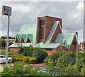
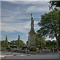
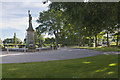
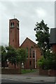
52 photos from this area
Area Information
Key information about the FY7 7BS including its size, population, and administrative classification.
- Area Type
- Postcode
- Area Size
- 3153 m²
- Population
- 1544
- Population Density
- 4798 people/km²
House Prices in FY7 7BS
8
Properties
£145,083
Average Sold Price
£63,000
Lowest Price
£375,000
Highest Price
Showing 8 properties
| Address | Type | Beds | Baths | Last Sale Price | Last Sale Date | |
|---|---|---|---|---|---|---|
| 213 Poulton Road, Fleetwood, FY7 7BS | Detached | 5 | 2 | £375,000 | Sep 2024 | |
| 215 Poulton Road, Fleetwood, FY7 7BS | Retail | 3 | 1 | £110,000 | Dec 2021 | |
| 210 Poulton Road, Fleetwood, FY7 7BS | Detached | 3 | - | £115,000 | Mar 2016 | |
| 217 Poulton Road, Fleetwood, FY7 7BS | house | - | - | £87,500 | Aug 2009 | |
| 212 Poulton Road, Fleetwood, FY7 7BS | Semi-detached | 3 | 1 | £120,000 | Jun 2004 | |
| 214 Poulton Road, Fleetwood, FY7 7BS | Semi-detached | - | - | £63,000 | Oct 2001 | |
| 208 Poulton Road, Fleetwood, FY7 7BS | Terraced | - | - | - | - | |
| 216 Poulton Road, Fleetwood, FY7 7BS | Terraced | - | - | - | - |
Energy Efficiency in FY7 7BS
Amenities
Schools
| Rank | School | Type | Entry gender | Ages |
|---|
Explore more schools in this area
Go to Schools tabDemographics
Household Size
Two person
most common
Accommodation Type
Houses
most common
Tenure
81
majority
Ethnic Group
White
most common
Religion
N/A
most common
Household Composition
N/A
most common
Age
47
median
Adults (30-64 years)
most common
Household Deprivation
N/A
with no deprivation
NS-SEC
25
in Lower managerial occupations
Explore more demographic insights in this area
Go to Demographics tabPlanning
Planning Constraints
- Flood RiskPremium
- Ramsar Wetland SitesPremium
- Area of Outstanding Natural BeautyPremium
- Protected Nature ReservePremium
- Protected WoodlandPremium