Area Overview for FY6 8FE
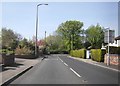
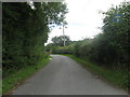
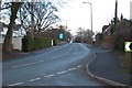
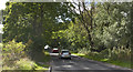
Photos of FY6 8FE

Area Information
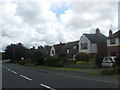
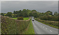
Living in FY6 8FE offers a compact, residential experience shaped by its small footprint of 3.2 hectares and a population of 1966 people. With a population density of 1014 people per square kilometre, this area is tightly knit, blending suburban comfort with proximity to essential services. The community is characterised by its mature demographic, with a median age of 47 and a strong presence of adults aged 30–64. Daily life here is defined by accessibility—within practical reach are five retail outlets, including Spar and Tesco Poulton, and multiple transport hubs like Poulton Rail Station and Blackpool North Railway Station. The area’s proximity to Blackpool International Airport and nearby bus routes enhances connectivity, while the low crime risk score of 85 ensures a sense of security. Though small, FY6 8FE is functional, with homes predominantly owner-occupied and focused on single-family housing. Its compact nature means residents are close to amenities, schools, and transport, making it ideal for those prioritising convenience over sprawling landscapes.
- Area Type
- Postcode
- Area Size
- 3.2 hectares
- Population
- 1966
- Population Density
- 1014 people/km²
The property market in FY6 8FE is dominated by owner-occupied homes, with 91% of properties in private hands. This high rate of home ownership indicates a stable, long-term resident base and limited rental activity. The area’s housing stock is primarily composed of houses, which is unusual for a small postcode area but suggests a focus on family-friendly, detached or semi-detached properties. Given the compact size of the area—just 3.2 hectares—there is limited scope for new development, meaning the existing housing stock is likely to remain relatively unchanged. For buyers, this presents a market where properties are likely to be well-established and in demand from those seeking secure, long-term investment. The absence of rental properties also implies that the area may not be a hotspot for short-term lets or speculative buyers, instead appealing to those prioritising permanence.
House Prices in FY6 8FE
Showing 5 properties
| Address | Type | Beds | Baths | Last Sale Price | Last Sale Date | |
|---|---|---|---|---|---|---|
| 1 Waterleat Glade, Poulton Le Fylde, FY6 8FE | Detached | 6 | 4 | £502,000 | Mar 2025 | |
| 5 Waterleat Glade, Poulton Le Fylde, FY6 8FE | house | - | - | £395,000 | Nov 2020 | |
| 4 Waterleat Glade, Poulton Le Fylde, FY6 8FE | house | - | - | £236,000 | Apr 2002 | |
| 2 Waterleat Glade, Poulton Le Fylde, FY6 8FE | Detached | - | - | £236,000 | Mar 2002 | |
| 3 Waterleat Glade, Poulton Le Fylde, FY6 8FE | Detached | 5 | - | £240,000 | Dec 2001 |
Energy Efficiency in FY6 8FE
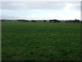
Daily life in FY6 8FE is supported by a range of nearby amenities, including five retail outlets such as Spar, Tesco Poulton, and Lidl Poulton-le, which provide essential shopping and dining options. The area’s transport links, including rail stations and metro stops, connect residents to broader networks for work, leisure, and travel. Blackpool International Airport is within reach, adding to the area’s accessibility. While parks and green spaces are not explicitly listed, the absence of planning constraints like AONB or protected woodlands suggests that the landscape is not heavily regulated, potentially allowing for local recreational use. The presence of multiple transport hubs and retail options ensures that residents can access daily necessities without long commutes, contributing to a practical, convenience-driven lifestyle.
Amenities
Schools
The nearest school to FY6 8FE is Poulton-le-Fylde Carr Head Primary School, which serves the local community with a good Ofsted rating. This primary school is the only educational institution explicitly listed for the area, indicating that families may need to travel to nearby secondary schools or consider broader regional options. The presence of a well-rated primary school is a key draw for families, as it ensures access to quality early education without long commutes. However, the absence of secondary schools in the immediate vicinity means parents may need to factor in additional travel time or explore nearby towns for secondary education. The single school listed underscores the importance of proximity to other educational facilities for a comprehensive schooling experience.
| Rank | School | Type | Entry gender | Ages |
|---|
Explore more schools in this area
Go to Schools tabDemographics
The community in FY6 8FE is predominantly composed of adults aged 30–64, reflecting a mature demographic with a median age of 47. Home ownership is exceptionally high at 91%, indicating a stable, long-term resident base. The area is largely composed of houses, aligning with the preference for private, family-oriented living. Ethnically, the population is predominantly White, though specific diversity metrics are not provided. The high home ownership rate suggests a low turnover of properties, fostering a sense of continuity. With 1966 residents spread over 3.2 hectares, the area’s density supports a compact, interconnected community. However, the lack of data on deprivation or income levels means the quality of life implications of this demographic profile remain unquantified. The focus on owner-occupied housing and mature age groups suggests a neighbourhood prioritising stability over transient lifestyles.
Household Size
Accommodation Type
Tenure
Ethnic Group
Religion
Household Composition
Age
Household Deprivation
NS-SEC
Explore more demographic insights in this area
Go to Demographics tabPlanning
Planning Constraints
- Flood RiskPremium
- Ramsar Wetland SitesPremium
- Area of Outstanding Natural BeautyPremium
- Protected Nature ReservePremium
- Protected WoodlandPremium