Area Overview for FY6 7RY
Photos of FY6 7RY


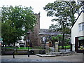

100 photos from this area
Area Information
Key information about the FY6 7RY including its size, population, and administrative classification.
- Area Type
- Postcode
- Area Size
- 5.2 hectares
- Population
- 1423
- Population Density
- 1663 people/km²
House Prices in FY6 7RY
55
Properties
£144,717
Average Sold Price
£44,000
Lowest Price
£279,950
Highest Price
Showing 55 properties
| Address | Type | Beds | Baths | Last Sale Price | Last Sale Date | |
|---|---|---|---|---|---|---|
| 70 Chester Avenue, Poulton Le Fylde, FY6 7RY | house | - | - | £190,500 | Jan 2025 | |
| 112 Chester Avenue, Poulton Le Fylde, FY6 7RY | Bungalow | 2 | 1 | £205,000 | Nov 2024 | |
| 74 Chester Avenue, Poulton Le Fylde, FY6 7RY | Semi-detached | 4 | 1 | £279,950 | Jul 2023 | |
| 92 Chester Avenue, Poulton Le Fylde, FY6 7RY | Bungalow | - | - | £165,000 | May 2023 | |
| 26 Chester Avenue, Poulton Le Fylde, FY6 7RY | Terraced | 3 | 1 | £180,000 | Dec 2022 | |
| 114 Chester Avenue, Poulton Le Fylde, FY6 7RY | Retail | 2 | 1 | £210,000 | Sep 2022 | |
| 118 Chester Avenue, Poulton Le Fylde, FY6 7RY | house | - | - | £220,000 | Sep 2022 | |
| 80 Chester Avenue, Poulton Le Fylde, FY6 7RY | Bungalow | - | - | £190,000 | Jul 2022 | |
| 78 Chester Avenue, Poulton Le Fylde, FY6 7RY | Bungalow | 3 | - | £184,950 | Dec 2020 | |
| 96 Chester Avenue, Poulton Le Fylde, FY6 7RY | Bungalow | 2 | 2 | £125,000 | Feb 2020 |
Page 1 of 6
Energy Efficiency in FY6 7RY
Amenities
Schools
| Rank | School | Type | Entry gender | Ages |
|---|
Explore more schools in this area
Go to Schools tabDemographics
Household Size
One person
most common
Accommodation Type
Houses
most common
Tenure
62
majority
Ethnic Group
White
most common
Religion
N/A
most common
Household Composition
N/A
most common
Age
47
median
Adults (30-64 years)
most common
Household Deprivation
N/A
with no deprivation
NS-SEC
35
in Lower managerial occupations
Explore more demographic insights in this area
Go to Demographics tabPlanning
Planning Constraints
- Flood RiskPremium
- Ramsar Wetland SitesPremium
- Area of Outstanding Natural BeautyPremium
- Protected Nature ReservePremium
- Protected WoodlandPremium