Area Overview for FY6 7DJ
Photos of FY6 7DJ
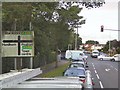

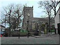
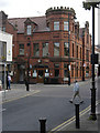

100 photos from this area
Area Information
Key information about the FY6 7DJ including its size, population, and administrative classification.
- Area Type
- Postcode
- Area Size
- 2.6 hectares
- Population
- 1495
- Population Density
- 3505 people/km²
House Prices in FY6 7DJ
39
Properties
£252,029
Average Sold Price
£100,000
Lowest Price
£402,000
Highest Price
Showing 39 properties
| Address | Type | Beds | Baths | Last Sale Price | Last Sale Date | |
|---|---|---|---|---|---|---|
| 17 Rydal Avenue, Poulton Le Fylde, FY6 7DJ | Bungalow | 3 | 1 | £360,000 | May 2025 | |
| 18 Rydal Avenue, Poulton Le Fylde, FY6 7DJ | Bungalow | - | - | £343,000 | May 2024 | |
| 10 Rydal Avenue, Poulton Le Fylde, FY6 7DJ | Bungalow | - | - | £255,000 | Apr 2024 | |
| 43 Rydal Avenue, Poulton Le Fylde, FY6 7DJ | Bungalow | 4 | 1 | £371,500 | Jul 2021 | |
| 33 Rydal Avenue, Poulton Le Fylde, FY6 7DJ | house | - | - | £402,000 | Jun 2021 | |
| 26 Rydal Avenue, Poulton Le Fylde, FY6 7DJ | Bungalow | - | - | £325,000 | Jan 2021 | |
| 1 Rydal Avenue, Poulton Le Fylde, FY6 7DJ | Bungalow | - | - | £260,000 | Dec 2020 | |
| 32 Rydal Avenue, Poulton Le Fylde, FY6 7DJ | Bungalow | 2 | 1 | £387,500 | Dec 2020 | |
| 28 Rydal Avenue, Poulton Le Fylde, FY6 7DJ | Bungalow | 2 | - | £242,500 | Apr 2018 | |
| 23 Rydal Avenue, Poulton Le Fylde, FY6 7DJ | Bungalow | 2 | - | £249,950 | Oct 2017 |
Page 1 of 4
Energy Efficiency in FY6 7DJ
Amenities
Schools
| Rank | School | Type | Entry gender | Ages |
|---|
Explore more schools in this area
Go to Schools tabDemographics
Household Size
Two person
most common
Accommodation Type
Houses
most common
Tenure
85
majority
Ethnic Group
White
most common
Religion
N/A
most common
Household Composition
N/A
most common
Age
47
median
Adults (30-64 years)
most common
Household Deprivation
N/A
with no deprivation
NS-SEC
42
in Lower managerial occupations
Explore more demographic insights in this area
Go to Demographics tabPlanning
Planning Constraints
- Flood RiskPremium
- Ramsar Wetland SitesPremium
- Area of Outstanding Natural BeautyPremium
- Protected Nature ReservePremium
- Protected WoodlandPremium