Area Overview for FY6 0FT
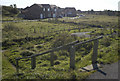
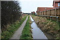
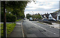
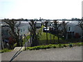
Photos of FY6 0FT


Area Information
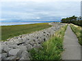
Living in FY6 0FT means being part of a tightly knit residential cluster in north-west England, where the population of 1,642 residents is spread across a compact area with a density of 702 people per square kilometre. This postcode is characterised by its quiet, mature community, with a median age of 47 and a strong presence of adults aged 30–64. The area’s small size fosters a sense of familiarity, with daily life centred around local amenities, transport links, and natural surroundings. Residents benefit from proximity to the Fleetwood Ferry, which connects to Knott End, and the nearby Poulton rail station, offering access to regional travel. The area’s appeal lies in its balance of practicality and tranquillity, with a focus on home ownership—80% of properties are owner-occupied—suggesting a stable, long-term resident base. While the community is not large, its infrastructure supports a self-contained lifestyle, from retail options like Co-op stores to recreational access via nearby waterways. For those seeking a place with a mix of convenience and low environmental risk, FY6 0FT offers a straightforward, no-frills living experience.
- Area Type
- Postcode
- Area Size
- Not available
- Population
- 1642
- Population Density
- 702 people/km²
The property market in FY6 0FT is dominated by owner-occupied homes, with 80% of properties in private hands. This high rate of home ownership suggests a community of long-term residents rather than a transient rental market. The accommodation type is primarily houses, which is unusual for a small postcode area but may indicate a focus on family homes or larger properties. Given the compact size of the area, the housing stock is likely limited, with few new developments. For buyers, this means a small pool of available properties, often with long-term occupants. The emphasis on houses rather than flats or apartments may appeal to those prioritising space or land. However, the lack of detailed data on property prices or recent transactions means the market’s competitiveness is unclear. Prospective buyers should consider the area’s limited size and the potential for a slow-moving market, particularly if seeking a specific type of property.
House Prices in FY6 0FT
No properties found in this postcode.
Energy Efficiency in FY6 0FT
Residents of FY6 0FT have access to a range of practical amenities within easy reach. The area includes five retail outlets, such as Co-op Preesall and Co-op Knott, providing essential shopping options. Two ferry services—Knott End and Fleetwood—offer convenient transport to nearby towns and coastal areas, enhancing connectivity. Five metro stations, including Fleetwood Ferry and London Street, support local travel, while the Poulton rail link provides access to further destinations. Though the data does not mention parks or leisure facilities, the presence of ferry services and proximity to waterways may suggest opportunities for outdoor activities. The combination of retail, transport, and ferry access creates a lifestyle that prioritises convenience and practicality, making daily errands and travel straightforward. The area’s small size means most amenities are within walking distance, fostering a self-contained, community-focused environment.
Amenities
Schools
The nearest school to FY6 0FT is Carter’s Charity Voluntary Controlled Primary School in Preesall, which serves the local community with a primary education offering. The school holds an Ofsted rating of satisfactory, indicating it meets basic standards but may have areas for improvement. As a primary school, it caters to younger children, though no secondary schools are listed in the data. The absence of higher education institutions or specialist schools means families may need to look beyond the immediate area for secondary schooling. For those prioritising proximity to schools, Carter’s Charity Primary provides a local option, but parents should consider additional travel time or resources for secondary education. The single school listed suggests a modest educational infrastructure, which may be sufficient for families with younger children but less so for those requiring a full range of school types.
| Rank | School | Type | Entry gender | Ages |
|---|
Explore more schools in this area
Go to Schools tabDemographics
The community in FY6 0FT is predominantly composed of adults aged 30–64, with a median age of 47, reflecting a mature, settled population. Home ownership is high, with 80% of residents living in properties they own, indicating a stable housing market and long-term residency. The accommodation type is largely houses, which is typical for smaller, rural or semi-rural postcode areas. The predominant ethnic group is White, with no specific data provided on other demographics. The population density of 702 people per square kilometre suggests a compact, closely packed residential area, though the low number of residents overall means the community remains intimate. There is no explicit data on deprivation levels, but the high home ownership rate and presence of essential amenities suggest a generally stable quality of life. The absence of significant diversity metrics means the area’s social fabric is largely homogenous, which may appeal to those seeking a familiar, cohesive environment.
Household Size
Accommodation Type
Tenure
Ethnic Group
Religion
Household Composition
Age
Household Deprivation
NS-SEC
Explore more demographic insights in this area
Go to Demographics tabPlanning
Planning Constraints
- Flood RiskPremium
- Ramsar Wetland SitesPremium
- Area of Outstanding Natural BeautyPremium
- Protected Nature ReservePremium
- Protected WoodlandPremium