Area Overview for FY5 4GD
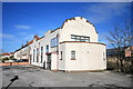
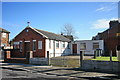
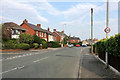
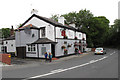
Photos of FY5 4GD


Area Information
Living in FY5 4GD offers a compact, tightly knit residential experience within a small cluster of homes. With a population of 1,710 and a density of 1,340 people per square kilometre, this area is characterised by its proximity to essential services and transport links. The community is predominantly composed of adults aged 30–64, reflecting a mature demographic that likely values stability and established infrastructure. Daily life here is shaped by the balance between local amenities and nearby connectivity. While the area is small, it is well-served by retail outlets, public transport, and schools, making it practical for families and professionals. The absence of major environmental constraints, such as protected woodlands or Areas of Outstanding Natural Beauty, means development is not restricted, though the area remains low-risk for flooding. For those seeking a quiet yet connected lifestyle, FY5 4GD provides a blend of convenience and community without the sprawl of larger towns.
- Area Type
- Postcode
- Area Size
- Not available
- Population
- 1710
- Population Density
- 1340 people/km²
The property market in FY5 4GD is defined by a high rate of home ownership (67%) and a predominance of houses. This suggests a market skewed towards owner-occupiers rather than renters, which may indicate a focus on long-term residency. The presence of houses, rather than flats or apartments, aligns with the area’s demographic profile of adults aged 30–64, who may prioritise space and family-friendly living. Given the small size of the area, the housing stock is likely limited, which could mean competition for properties. Buyers should consider the proximity to amenities and transport links as key factors, as these are critical for quality of life in a compact community. The lack of significant planning constraints, such as protected woodlands or AONB designations, may also make the area more accessible for development or renovation.
House Prices in FY5 4GD
No properties found in this postcode.
Energy Efficiency in FY5 4GD
Residents of FY5 4GD enjoy a range of nearby amenities that support daily life. Retail options include Spar, Tesco Thornton, and Co-op Victoria, ensuring easy access to groceries and essentials. Metro stops at West Drive, Cleveleys, and Thornton Gate provide convenient local travel, while rail services to Poulton and Blackpool North connect to broader networks. Ferry services to Fleetwood and Knott End add a coastal dimension, ideal for leisure or commuting. The Central Coach Station offers bus links, though options are limited compared to rail. The area’s compact nature means amenities are within practical reach, fostering a self-contained lifestyle. While there are no named parks or leisure facilities in the data, the presence of multiple transport and retail hubs suggests a focus on practicality over expansive recreational spaces. This setup suits those prioritising convenience over large-scale leisure opportunities.
Amenities
Schools
Residents of FY5 4GD have access to a mix of primary and special schools. Thornton Primary School, a primary institution with a ‘good’ Ofsted rating, provides local education for younger children. For special needs education, Great Arley School and Thornton-Cleveleys Red Marsh School cater to students with specific requirements. This combination ensures families can find appropriate schooling within the area, reducing the need for long commutes. The presence of both general and special schools reflects a commitment to inclusive education, which is crucial for diverse household needs. However, the absence of secondary schools in the immediate vicinity may require families to seek options further afield. This balance of educational provision supports both local and broader family planning, though parents should verify the suitability of specific schools for their children’s needs.
| Rank | School | Type | Entry gender | Ages |
|---|
Explore more schools in this area
Go to Schools tabDemographics
The population of FY5 4GD is 1,710, with a median age of 47. This suggests a community skewed towards middle-aged and older residents, with the most common age range being 30–64 years. Home ownership stands at 67%, indicating a stable, long-term resident base rather than a transient rental market. The accommodation type is primarily houses, which aligns with the demographic profile of families or individuals seeking more space. The predominant ethnic group is White, reflecting the broader regional trends. While no specific data on deprivation is provided, the high home ownership rate and mature age profile suggest a relatively stable economic environment. This demographic structure likely influences the area’s social dynamics, with a focus on established routines and community cohesion rather than rapid change.
Household Size
Accommodation Type
Tenure
Ethnic Group
Religion
Household Composition
Age
Household Deprivation
NS-SEC
Explore more demographic insights in this area
Go to Demographics tabPlanning
Planning Constraints
- Flood RiskPremium
- Ramsar Wetland SitesPremium
- Area of Outstanding Natural BeautyPremium
- Protected Nature ReservePremium
- Protected WoodlandPremium