Area Overview for FY5 4BP
Photos of FY5 4BP
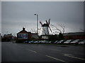
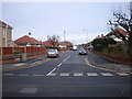
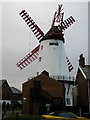
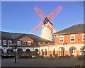

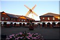
50 photos from this area
Area Information
Key information about the FY5 4BP including its size, population, and administrative classification.
- Area Type
- Postcode
- Area Size
- 1.1 hectares
- Population
- 1710
- Population Density
- 1340 people/km²
House Prices in FY5 4BP
39
Properties
£111,769
Average Sold Price
£45,000
Lowest Price
£191,570
Highest Price
Showing 39 properties
| Address | Type | Beds | Baths | Last Sale Price | Last Sale Date | |
|---|---|---|---|---|---|---|
| 29 Sandyforth Avenue, Thornton Cleveleys, FY5 4BP | house | 3 | 1 | £160,000 | Mar 2025 | |
| 59 Sandyforth Avenue, Thornton Cleveleys, FY5 4BP | house | 3 | 1 | £75,000 | Jan 2025 | |
| 3 Sandyforth Avenue, Thornton Cleveleys, FY5 4BP | Semi-detached | 3 | 1 | £190,000 | May 2024 | |
| 39 Sandyforth Avenue, Thornton Cleveleys, FY5 4BP | house | 3 | - | £191,570 | Dec 2023 | |
| 45 Sandyforth Avenue, Thornton Cleveleys, FY5 4BP | Semi-detached | 3 | 1 | £127,000 | Jul 2023 | |
| 63 Sandyforth Avenue, Thornton Cleveleys, FY5 4BP | Terraced | 3 | 1 | £133,000 | Jun 2023 | |
| 65 Sandyforth Avenue, Thornton Cleveleys, FY5 4BP | Terraced | 3 | 1 | £128,500 | Apr 2023 | |
| 33 Sandyforth Avenue, Thornton Cleveleys, FY5 4BP | Semi-detached | 3 | - | £130,000 | Jan 2023 | |
| 67 Sandyforth Avenue, Thornton Cleveleys, FY5 4BP | Retail | 2 | 1 | £125,000 | Jun 2022 | |
| 27 Sandyforth Avenue, Thornton Cleveleys, FY5 4BP | Retail | 3 | 1 | £173,000 | Jun 2022 |
Page 1 of 4
Energy Efficiency in FY5 4BP
Amenities
Schools
| Rank | School | Type | Entry gender | Ages |
|---|
Explore more schools in this area
Go to Schools tabDemographics
Household Size
Two person
most common
Accommodation Type
Houses
most common
Tenure
67
majority
Ethnic Group
White
most common
Religion
N/A
most common
Household Composition
N/A
most common
Age
47
median
Adults (30-64 years)
most common
Household Deprivation
N/A
with no deprivation
NS-SEC
25
in Lower managerial occupations
Explore more demographic insights in this area
Go to Demographics tabPlanning
Planning Constraints
- Flood RiskPremium
- Ramsar Wetland SitesPremium
- Area of Outstanding Natural BeautyPremium
- Protected Nature ReservePremium
- Protected WoodlandPremium