Area Overview for FY5 2TW
Photos of FY5 2TW


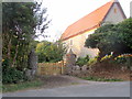

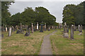


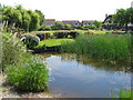

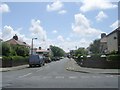
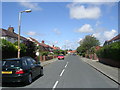
39 photos from this area
Area Information
Key information about the FY5 2TW including its size, population, and administrative classification.
- Area Type
- Postcode
- Area Size
- 3.5 hectares
- Population
- 1416
- Population Density
- 2986 people/km²
House Prices in FY5 2TW
35
Properties
£226,276
Average Sold Price
£60,000
Lowest Price
£620,000
Highest Price
Showing 35 properties
| Address | Type | Beds | Baths | Last Sale Price | Last Sale Date | |
|---|---|---|---|---|---|---|
| Old Parish Hall, 41A Meadows Avenue, Thornton Cleveleys, FY5 2TW | Detached | 5 | 4 | £620,000 | Feb 2025 | |
| 32 Meadows Avenue, Thornton Cleveleys, FY5 2TW | Bungalow | 4 | 2 | £345,000 | Jul 2024 | |
| 69 Meadows Avenue, Thornton Cleveleys, FY5 2TW | Bungalow | 3 | - | £380,000 | Nov 2022 | |
| 74 Meadows Avenue, Thornton Cleveleys, FY5 2TW | Bungalow | 2 | 1 | £225,160 | Apr 2022 | |
| 51 Meadows Avenue, Thornton Cleveleys, FY5 2TW | Detached | - | - | £166,000 | Dec 2020 | |
| 71 Meadows Avenue, Thornton Cleveleys, FY5 2TW | Bungalow | 3 | - | £335,000 | Sep 2020 | |
| 59 Meadows Avenue, Thornton Cleveleys, FY5 2TW | Bungalow | 3 | 2 | £323,000 | Aug 2019 | |
| 62 Meadows Avenue, Thornton Cleveleys, FY5 2TW | Bungalow | 3 | - | £267,000 | Aug 2017 | |
| 72 Meadows Avenue, Thornton Cleveleys, FY5 2TW | Bungalow | 2 | 1 | £180,000 | Jul 2017 | |
| 63 Meadows Avenue, Thornton Cleveleys, FY5 2TW | Bungalow | 3 | 1 | £164,000 | Jul 2015 |
Page 1 of 4
Energy Efficiency in FY5 2TW
Amenities
Schools
| Rank | School | Type | Entry gender | Ages |
|---|
Explore more schools in this area
Go to Schools tabDemographics
Household Size
Two person
most common
Accommodation Type
Houses
most common
Tenure
90
majority
Ethnic Group
White
most common
Religion
N/A
most common
Household Composition
N/A
most common
Age
47
median
Adults (30-64 years)
most common
Household Deprivation
N/A
with no deprivation
NS-SEC
37
in Lower managerial occupations
Explore more demographic insights in this area
Go to Demographics tabPlanning
Planning Constraints
- Flood RiskPremium
- Ramsar Wetland SitesPremium
- Area of Outstanding Natural BeautyPremium
- Protected Nature ReservePremium
- Protected WoodlandPremium