Area Overview for FY5 2HQ
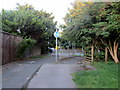
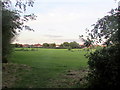
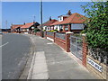
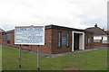
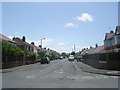
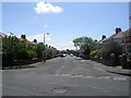
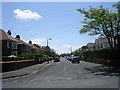
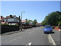
Photos of FY5 2HQ


Area Information
Living in FY5 2HQ means being part of a compact, residential cluster in England with a population of just 1400 people. This small area is defined by its low population density and quiet, established character. The community is predominantly composed of adults aged 30–64, with a median age of 47, suggesting a stable, mature demographic. Most residents own their homes, reflecting a strong sense of permanence. Daily life here is shaped by proximity to essential services, including supermarkets like Sainsburys and Morrisons in nearby Cleveleys, and multiple rail and metro stops within reach. The area’s safety profile is a key draw, with a crime risk score of 91 (low risk) and no significant environmental hazards. While the postcode covers a limited physical footprint, its strategic location near Fleetwood and Blackpool offers access to broader regional amenities. For those seeking a balance between tranquillity and connectivity, FY5 2HQ provides a snapshot of small-town living with practical infrastructure.
- Area Type
- Postcode
- Area Size
- Not available
- Population
- 1400
- Population Density
- 3311 people/km²
The property market in FY5 2HQ is characterised by a high rate of home ownership (83%) and a focus on houses rather than flats or apartments. This suggests a market skewed toward owner-occupied properties, with limited rental activity. The area’s small size means the housing stock is concentrated, and buyers may find fewer options within the postcode itself, though nearby areas like Cleveleys and Fleetwood offer additional choices. The prevalence of houses indicates a preference for larger, private living spaces, which may appeal to families or those seeking space. However, the limited population (1400) means the market is not expansive, and property values may be influenced by regional factors such as proximity to transport links and amenities. For buyers, this area is best suited to those prioritising ownership over rental flexibility, with the need to consider surrounding neighbourhoods for broader options.
House Prices in FY5 2HQ
No properties found in this postcode.
Energy Efficiency in FY5 2HQ
Residents of FY5 2HQ have access to a range of amenities within practical reach. The retail sector includes major supermarkets such as Sainsburys Cleveleys, Morrisons Cleveleys, and Co-op Fleetwood, ensuring everyday shopping needs are met. Metro stops like West Drive and Cleveleys offer easy access to local services, while rail stations at Poulton and Blackpool North connect to broader networks. Ferry services to Knott End provide a unique link to coastal areas, enhancing leisure opportunities. The presence of multiple transport options, combined with nearby retail and dining choices, supports a convenient, active lifestyle. Though the area itself is small, its integration with surrounding towns means residents can enjoy a mix of local charm and regional amenities without long commutes.
Amenities
Schools
| Rank | School | Type | Entry gender | Ages |
|---|
Explore more schools in this area
Go to Schools tabDemographics
The community in FY5 2HQ is largely composed of adults aged 30–64, with a median age of 47. This suggests a population that is predominantly in their prime working years, with fewer young families or elderly residents. Home ownership is high, at 83%, indicating a strong local presence and long-term investment in property. The accommodation type is primarily houses, which aligns with the area’s low population density and residential character. The predominant ethnic group is White, with no specific data on diversity beyond this. The absence of detailed information on household composition or deprivation levels means the area’s social dynamics remain relatively uniform. For residents, this translates to a stable, low-mobility community where most people live in their own homes, contributing to a cohesive, familiar environment.
Household Size
Accommodation Type
Tenure
Ethnic Group
Religion
Household Composition
Age
Household Deprivation
NS-SEC
Explore more demographic insights in this area
Go to Demographics tabPlanning
Planning Constraints
- Flood RiskPremium
- Ramsar Wetland SitesPremium
- Area of Outstanding Natural BeautyPremium
- Protected Nature ReservePremium
- Protected WoodlandPremium