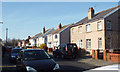
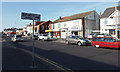
Area Overview for FY4 1JF
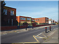
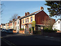
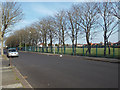
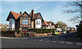
Photos of FY4 1JF


Area Information
Living in FY4 1JF means being part of a tightly packed residential cluster in England, where 1,439 people reside across just 3,645 square metres. This compact area, with a population density of 394,823 people per square kilometre, reflects a densely populated yet small-scale community. The postcode is characterised by its proximity to key amenities, including schools, transport hubs, and retail outlets. Daily life here is shaped by its proximity to Blackpool’s landmarks, such as Pleasure Beach and the international airport, which provide easy access to leisure and travel. The area’s small size means residents are likely to know their neighbours, fostering a close-knit environment. While the density is high, the area’s infrastructure—ranging from rail stations to supermarkets—ensures practicality for everyday needs. FY4 1JF is ideal for those seeking a balance between urban convenience and a manageable, community-focused lifestyle, with minimal risk of environmental or safety concerns.
- Area Type
- Postcode
- Area Size
- 3645 m²
- Population
- 1439
- Population Density
- 394823 people/km²
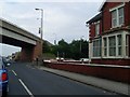
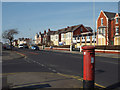
The property market in FY4 1JF is dominated by owner-occupied homes, with 70% of properties in private hands. The accommodation type is primarily houses, which is unusual for a small, high-density area. This suggests a mix of semi-detached or terraced housing, typical of older residential clusters. The limited size of the area means the housing stock is finite, potentially making it a competitive market for buyers. Given the high home ownership rate, rental availability may be constrained, though the proximity to transport links and amenities could attract investors. For buyers, the focus would be on securing a home in a compact, well-serviced postcode, with the added benefit of low environmental risks. The area’s small footprint means properties are likely to be close to key facilities, though the density may impact privacy and space.
House Prices in FY4 1JF
Showing 1 properties
| Address | Type | Beds | Baths | Last Sale Price | Last Sale Date | |
|---|---|---|---|---|---|---|
| 476 Lytham Road, Blackpool, FY4 1JF | Terraced | - | - | - | - |
Energy Efficiency in FY4 1JF
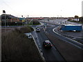
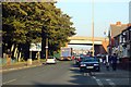
Residents of FY4 1JF enjoy access to a range of amenities within practical reach. The area’s proximity to Pleasure Beach and Burlington Road West offers leisure opportunities, while retail outlets like Tesco South and Morrisons Daily cater to daily shopping needs. The nearby Blackpool International Airport provides easy travel connections. Public transport is extensive, with five metro stops, three rail stations, and a bus service from the Central Coach Station, ensuring mobility for work, shopping, or leisure. The compact nature of the area means amenities are close, reducing travel time. While the data does not detail parks or dining options, the presence of multiple retail and transport hubs suggests a convenient, active lifestyle. The mix of leisure, shopping, and transport links makes FY4 1JF suitable for those prioritising accessibility and practicality.
Amenities
Schools
Residents of FY4 1JF have access to two notable schools. Aks Blackpool is an independent school, offering a fee-paying alternative for families seeking private education. Nearby, Armfield Academy is an academy with a Good Ofsted rating, providing a state-funded option with a focus on academic performance. The presence of both independent and state schools offers flexibility for parents, whether they prioritise fee-based education or public schooling. Armfield Academy’s Good rating indicates a reliable standard of teaching and facilities, which is crucial for families. The proximity of these institutions to the area means children can attend without long commutes. However, the data does not specify school catchment areas or student numbers, so prospective buyers should verify admissions policies.
| Rank | School | Type | Entry gender | Ages |
|---|
Explore more schools in this area
Go to Schools tabDemographics
The community in FY4 1JF is predominantly composed of adults aged 30–64, with a median age of 47. This suggests a mature, stable population, likely with established careers and families. Home ownership is high at 70%, indicating a strong presence of long-term residents. The area is largely occupied by houses, which aligns with the demographic profile of older, settled households. The predominant ethnic group is White, reflecting the broader regional composition. The high population density—394,823 people per square kilometre—means the area is intensely populated, which can influence local services and social dynamics. While the data does not specify deprivation levels, the combination of high home ownership and a mature age range may suggest a relatively stable economic environment, though the density could strain shared resources.
Household Size
Accommodation Type
Tenure
Ethnic Group
Religion
Household Composition
Age
Household Deprivation
NS-SEC
Explore more demographic insights in this area
Go to Demographics tabPlanning
Planning Constraints
- Flood RiskPremium
- Ramsar Wetland SitesPremium
- Area of Outstanding Natural BeautyPremium
- Protected Nature ReservePremium
- Protected WoodlandPremium