Area Overview for FY2 9EN
Photos of FY2 9EN

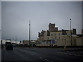
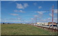
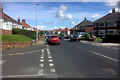
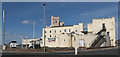

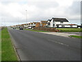
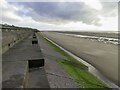
49 photos from this area
Area Information
Key information about the FY2 9EN including its size, population, and administrative classification.
- Area Type
- Postcode
- Area Size
- 6043 m²
- Population
- 1467
- Population Density
- 5595 people/km²
House Prices in FY2 9EN
16
Properties
£108,954
Average Sold Price
£57,000
Lowest Price
£162,000
Highest Price
Showing 16 properties
| Address | Type | Beds | Baths | Last Sale Price | Last Sale Date | |
|---|---|---|---|---|---|---|
| 59 Norcliffe Road, Blackpool, FY2 9EN | house | - | - | £95,000 | Jul 2023 | |
| 61 Norcliffe Road, Blackpool, FY2 9EN | Semi-detached | 3 | 1 | £162,000 | Oct 2022 | |
| 107 Norcliffe Road, Blackpool, FY2 9EN | house | - | - | £126,000 | Jul 2021 | |
| 65 Norcliffe Road, Blackpool, FY2 9EN | house | - | - | £120,000 | Mar 2021 | |
| 95 Norcliffe Road, Blackpool, FY2 9EN | house | 3 | - | £155,000 | Oct 2020 | |
| 89 Norcliffe Road, Blackpool, FY2 9EN | Semi-detached | 3 | 1 | £132,000 | Mar 2020 | |
| 93 Norcliffe Road, Blackpool, FY2 9EN | house | - | - | £135,000 | Oct 2010 | |
| 67 Norcliffe Road, Blackpool, FY2 9EN | Semi-detached | - | - | £143,500 | Jul 2006 | |
| 101 Norcliffe Road, Blackpool, FY2 9EN | Detached | 3 | - | £93,000 | Jul 2002 | |
| 103 Norcliffe Road, Blackpool, FY2 9EN | Semi-detached | - | - | £78,000 | Aug 2000 |
Page 1 of 2
Energy Efficiency in FY2 9EN
Amenities
Schools
| Rank | School | Type | Entry gender | Ages |
|---|
Explore more schools in this area
Go to Schools tabDemographics
Household Size
Two person
most common
Accommodation Type
Houses
most common
Tenure
86
majority
Ethnic Group
White
most common
Religion
N/A
most common
Household Composition
N/A
most common
Age
47
median
Adults (30-64 years)
most common
Household Deprivation
N/A
with no deprivation
NS-SEC
33
in Lower managerial occupations
Explore more demographic insights in this area
Go to Demographics tabPlanning
Planning Constraints
- Flood RiskPremium
- Ramsar Wetland SitesPremium
- Area of Outstanding Natural BeautyPremium
- Protected Nature ReservePremium
- Protected WoodlandPremium