Area Overview for FY2 0AZ
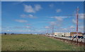
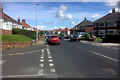
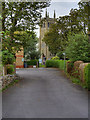
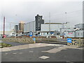
Photos of FY2 0AZ


Area Information
Living in FY2 0AZ means inhabiting a tightly knit residential cluster in England, where 1,450 people reside across just 1.7 hectares. This small area, though compact, offers a high population density of 85,289 people per square kilometre, reflecting a densely populated yet focused community. The area is characterised by its predominantly housing stock, with a strong emphasis on owner-occupied properties. Daily life here is shaped by proximity to essential services, including multiple retail outlets, transport links, and educational institutions. The presence of several schools, such as St Bernadette’s Catholic Primary School and Montgomery Academy, suggests a family-oriented environment. While the area’s size is limited, its strategic location near transport hubs like Blackpool North Railway Station and nearby ferry services to Knott End ensures connectivity. However, the high population density and small footprint mean that the community is both close-knit and intensely utilised, with little room for expansion. For those seeking a compact, service-rich environment, FY2 0AZ offers a blend of residential stability and practical accessibility.
- Area Type
- Postcode
- Area Size
- 1.7 hectares
- Population
- 1450
- Population Density
- 4003 people/km²
The property market in FY2 0AZ is dominated by owner-occupied homes, with 78% of residents owning their properties. This high rate of home ownership suggests a stable, long-term community with limited rental activity. The area’s housing stock is primarily composed of houses, which contrasts with areas where flats or apartments predominate. Given the small size of the area—just 1.7 hectares—the housing stock is likely limited in volume, with properties closely spaced. For buyers, this means a focus on individual homes rather than larger developments. The compact nature of the area may also mean that properties are highly sought after, particularly for those prioritising proximity to amenities like schools and transport. However, the lack of expansion potential means that the market is likely to remain steady, with limited new supply.
House Prices in FY2 0AZ
No properties found in this postcode.
Energy Efficiency in FY2 0AZ
The lifestyle in FY2 0AZ is shaped by its proximity to a variety of amenities. Retail options include Tesco Bispham, Heron Bispham, and Morrisons Daily, providing everyday shopping needs. The area’s transport links, such as Blackpool North Railway Station and nearby bus routes, connect residents to broader networks, while ferry services to Knott End offer access to coastal leisure. The presence of multiple schools and community hubs suggests a focus on family life. The compact nature of the area means that amenities are closely clustered, reducing travel time for essentials. However, the lack of detailed information on parks or recreational spaces means the area’s leisure options are not explicitly outlined. Overall, the lifestyle here balances practicality with access to services, though the small footprint may limit opportunities for expansive community activities.
Amenities
Schools
Residents of FY2 0AZ have access to a range of educational institutions, including primary schools such as St Bernadette’s Catholic Primary School and Montgomery High School, which is described as a language college and full-service school. Montgomery Academy, an academy with a good Ofsted rating, adds diversity to the educational landscape. The presence of multiple primary schools suggests a strong focus on early education, while the academy provides options for secondary schooling. Families in the area benefit from a mix of school types, allowing them to choose between traditional state schools and academies. The good rating at Montgomery Academy indicates a reputable institution, which could be a key factor for parents prioritising quality education. However, the absence of specific data on school performance metrics beyond Ofsted ratings means further details on academic outcomes are not available.
| Rank | School | Type | Entry gender | Ages |
|---|
Explore more schools in this area
Go to Schools tabDemographics
The community in FY2 0AZ is predominantly composed of adults aged 30–64, with a median age of 47. This suggests a mature, established population, likely with long-term ties to the area. Home ownership is high, with 78% of residents owning their properties, indicating a stable housing market and a preference for long-term residency. The accommodation type is largely houses, which aligns with the area’s residential character. The predominant ethnic group is White, reflecting a homogenous demographic profile. The absence of specific data on deprivation or diversity metrics means the area’s social dynamics are not explicitly detailed, but the high home ownership and age profile suggest a community focused on settled, family-oriented living. The density of the population, however, may influence the availability of shared spaces or community facilities.
Household Size
Accommodation Type
Tenure
Ethnic Group
Religion
Household Composition
Age
Household Deprivation
NS-SEC
Explore more demographic insights in this area
Go to Demographics tabPlanning
Planning Constraints
- Flood RiskPremium
- Ramsar Wetland SitesPremium
- Area of Outstanding Natural BeautyPremium
- Protected Nature ReservePremium
- Protected WoodlandPremium