Area Overview for FY1 6SH
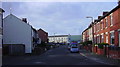
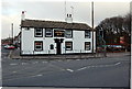
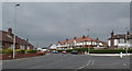
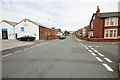
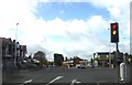
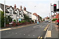
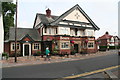
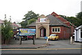
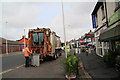
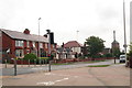
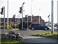
Photos of FY1 6SH

Area Information
Living in FY1 6SH means inhabiting a compact residential cluster in England, home to 1,463 residents. This small area is characterised by a mature demographic, with a median age of 47 and a majority of residents aged 30–64. The community is predominantly owner-occupied, with 70% of homes owned by residents, and most properties are houses rather than flats. Daily life here is shaped by proximity to essential services, including five special schools and multiple transport links. The area’s modest size means it is tightly integrated with nearby towns, offering a blend of local convenience and regional connectivity. Residents benefit from excellent broadband (97/100) and reliable mobile coverage (85/100), supporting both domestic and professional needs. While the population is small, the area’s infrastructure ensures practical access to shopping, transport, and leisure. FY1 6SH is not a sprawling suburb but a focused neighbourhood where community ties are likely strong, and the pace of life is slower compared to larger urban centres.
- Area Type
- Postcode
- Area Size
- Not available
- Population
- 1463
- Population Density
- Not available
The property market in FY1 6SH is dominated by owner-occupied homes, with 70% of properties owned by residents. This suggests a stable market where long-term residency is common, and rental activity is less prominent. The accommodation type is predominantly houses, which is typical of smaller, residential clusters. Given the area’s compact size, the housing stock is likely limited in volume but may offer a range of house types. Buyers should consider the proximity to amenities such as schools, transport, and retail, which are within practical reach. The high home ownership rate indicates that properties here are likely to be well-maintained and have strong local demand. However, the small population means the market is niche, and buyers may need to look beyond the immediate postcode for broader options. The focus on houses rather than flats also implies a preference for private, family-oriented living spaces.
House Prices in FY1 6SH
No properties found in this postcode.
Energy Efficiency in FY1 6SH
The lifestyle in FY1 6SH is shaped by its proximity to essential amenities. Retail options include major stores such as Tesco Blackpool, Aldi Park, and Iceland Blackpool, ensuring convenient access to groceries and household goods. The area’s transport links, including multiple railway stations and metro stops, provide easy access to Blackpool and surrounding areas, supporting both commuting and leisure activities. The nearby Blackpool International Airport adds to the area’s connectivity, offering travel opportunities beyond the region. For residents, the combination of retail, transport, and regional access creates a practical living environment. While the area’s small size limits the diversity of amenities, the availability of key services and transport hubs ensures that daily life remains efficient and connected. The presence of multiple schools and transport options also makes the area appealing for families seeking balance between local convenience and regional reach.
Amenities
Schools
The area is served by five special schools, including The Nook School, Applegate School, Mill House School, Pennsylvania House, and Glendale House. All are designated as special schools, catering to students with specific educational needs. This concentration of special schools suggests that the area may attract families requiring tailored educational support. While the data does not provide Ofsted ratings, the presence of multiple special schools indicates a structured approach to education in the region. Families with children in need of specialist provision will find the area well-served, though those seeking mainstream schooling may need to look further afield. The proximity of these schools to FY1 6SH ensures that daily commutes for students and parents are manageable, reinforcing the area’s appeal for families with specific educational requirements.
| Rank | School | Type | Entry gender | Ages |
|---|
Explore more schools in this area
Go to Schools tabDemographics
The population of FY1 6SH is 1,463, with a median age of 47, indicating a mature community. The majority of residents fall within the 30–64 age range, suggesting a stable demographic with a focus on middle-aged families and professionals. Home ownership is high at 70%, reflecting a community where property is predominantly owner-occupied rather than rented. The accommodation type is primarily houses, which aligns with the area’s small, residential character. The predominant ethnic group is White, though specific data on diversity or deprivation is not provided. The age profile implies a population that may be less reliant on state services for children or elderly care, and the high home ownership rate suggests long-term residency and investment in the area. This demographic structure likely influences local amenities and services, which are tailored to the needs of a settled, middle-aged population.
Household Size
Accommodation Type
Tenure
Ethnic Group
Religion
Household Composition
Age
Household Deprivation
NS-SEC
Explore more demographic insights in this area
Go to Demographics tabPlanning
Planning Constraints
- Flood RiskPremium
- Ramsar Wetland SitesPremium
- Area of Outstanding Natural BeautyPremium
- Protected Nature ReservePremium
- Protected WoodlandPremium