Area Overview for FY1 6JA
Photos of FY1 6JA
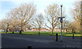


100 photos from this area
Area Information
Key information about the FY1 6JA including its size, population, and administrative classification.
- Area Type
- Postcode
- Area Size
- 2.0 hectares
- Population
- 1741
- Population Density
- 85747 people/km²
House Prices in FY1 6JA
26
Properties
£69,838
Average Sold Price
£26,000
Lowest Price
£125,000
Highest Price
Showing 26 properties
| Address | Type | Beds | Baths | Last Sale Price | Last Sale Date | |
|---|---|---|---|---|---|---|
| 19 Westbourne Avenue, Blackpool, FY1 6JA | house | 4 | - | £125,000 | Sep 2025 | |
| 11 Westbourne Avenue, Blackpool, FY1 6JA | Terraced | 4 | 1 | £100,000 | May 2019 | |
| 16 Westbourne Avenue, Blackpool, FY1 6JA | Terraced | 5 | 1 | £67,000 | Mar 2018 | |
| 2 Westbourne Avenue, Blackpool, FY1 6JA | Terraced | 4 | 2 | £60,000 | May 2015 | |
| 12B Westbourne Avenue, Blackpool, FY1 6JA | Terraced | 4 | 1 | £64,950 | Apr 2013 | |
| 15 Westbourne Avenue, Blackpool, FY1 6JA | house | - | - | £74,000 | Dec 2012 | |
| 8 Westbourne Avenue, Blackpool, FY1 6JA | Terraced | 4 | 2 | £65,000 | Feb 2007 | |
| 17 Westbourne Avenue, Blackpool, FY1 6JA | house | 4 | - | £115,000 | Feb 2006 | |
| 10 Westbourne Avenue, Blackpool, FY1 6JA | Terraced | 4 | 1 | £100,000 | Sep 2004 | |
| 9 Westbourne Avenue, Blackpool, FY1 6JA | house | 4 | - | £55,000 | Sep 2002 |
Page 1 of 3
Energy Efficiency in FY1 6JA
Amenities
Schools
| Rank | School | Type | Entry gender | Ages |
|---|
Explore more schools in this area
Go to Schools tabDemographics
Household Size
One person
most common
Accommodation Type
Houses
most common
Tenure
44
majority
Ethnic Group
White
most common
Religion
N/A
most common
Household Composition
N/A
most common
Age
47
median
Adults (30-64 years)
most common
Household Deprivation
N/A
with no deprivation
NS-SEC
16
in Lower managerial occupations
Explore more demographic insights in this area
Go to Demographics tabPlanning
Planning Constraints
- Flood RiskPremium
- Ramsar Wetland SitesPremium
- Area of Outstanding Natural BeautyPremium
- Protected Nature ReservePremium
- Protected WoodlandPremium