Area Overview for FY1 5DS
Photos of FY1 5DS
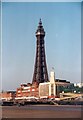

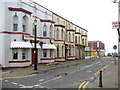
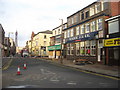
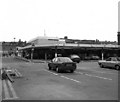
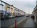
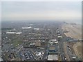
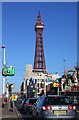

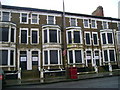
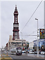
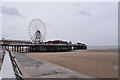
100 photos from this area
Area Information
Key information about the FY1 5DS including its size, population, and administrative classification.
- Area Type
- Postcode
- Area Size
- 2229 m²
- Population
- 1333
- Population Density
- 598023 people/km²
House Prices in FY1 5DS
23
Properties
£53,667
Average Sold Price
£28,000
Lowest Price
£85,000
Highest Price
Showing 23 properties
| Address | Type | Beds | Baths | Last Sale Price | Last Sale Date | |
|---|---|---|---|---|---|---|
| 134A Central Drive, Blackpool, FY1 5DS | Flat | - | - | £85,000 | Jun 2021 | |
| Ground Floor Flat Rear (67a), 65-A-67 Central Drive, Blackpool, FY1 5DS | undefined | - | - | £48,000 | Jul 2004 | |
| Inspired By Ink, 65 Central Drive, Blackpool, FY1 5DS | Retail | - | - | £28,000 | Jan 1999 | |
| First Floor Flat, 55 Central Drive, Blackpool, FY1 5DS | Retail | 3 | - | - | - | |
| Flat 1, 53 Central Drive, Blackpool, FY1 5DS | Retail | - | - | - | - | |
| Flat 2, 65 Central Drive, Blackpool, FY1 5DS | Flat | - | - | - | - | |
| Flat 2, 53 Central Drive, Blackpool, FY1 5DS | Flat | - | - | - | - | |
| 59, 59 Central Drive, Blackpool, FY1 5DS | Flat | - | - | - | - | |
| Flat 7, 61 Central Drive, Blackpool, FY1 5DS | Flat | - | - | - | - | |
| 57, 57 Central Drive, Blackpool, FY1 5DS | Flat | - | - | - | - |
Page 1 of 3
Energy Efficiency in FY1 5DS
Amenities
Schools
| Rank | School | Type | Entry gender | Ages |
|---|
Explore more schools in this area
Go to Schools tabDemographics
Household Size
One person
most common
Accommodation Type
Houses
most common
Tenure
21
majority
Ethnic Group
White
most common
Religion
N/A
most common
Household Composition
N/A
most common
Age
47
median
Adults (30-64 years)
most common
Household Deprivation
N/A
with no deprivation
NS-SEC
9
in Lower managerial occupations
Explore more demographic insights in this area
Go to Demographics tabPlanning
Planning Constraints
- Flood RiskPremium
- Ramsar Wetland SitesPremium
- Area of Outstanding Natural BeautyPremium
- Protected Nature ReservePremium
- Protected WoodlandPremium