Area Overview for FY1 4EE
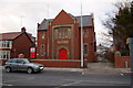
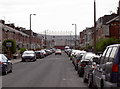
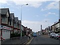
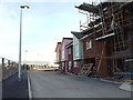
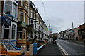
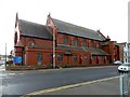
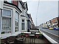
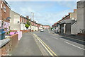
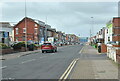
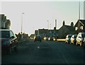
Photos of FY1 4EE


Area Information
Living in FY1 4EE means being part of a tightly knit, small-scale residential cluster in England. The area covers just 4,406 square metres, housing 1,139 people in a densely populated 258,503 people per square kilometre. This compact layout creates a sense of familiarity, where daily life is shaped by proximity to local amenities and transport hubs. The area’s character is defined by its mix of practicality and accessibility, with residents benefiting from nearby retail, public transport, and connectivity. While the population is modest, the density suggests a community where social interactions are frequent. FY1 4EE is not a sprawling suburb but a focused postcode where homes are closely spaced, and the rhythm of life is dictated by the surrounding infrastructure. For those seeking a place where essentials are within reach without the sprawl of larger towns, this area offers a compact, functional living environment. Its small size means that residents are likely to know their neighbours, and the area’s proximity to Blackpool’s broader amenities adds to its appeal for those who value convenience without sacrificing a sense of community.
- Area Type
- Postcode
- Area Size
- 4406 m²
- Population
- 1139
- Population Density
- 6011 people/km²
The property market in FY1 4EE is characterised by a high rate of home ownership—67% of residents own their homes. This suggests a stable, long-term market where properties are likely to retain value. The accommodation type is predominantly houses, which contrasts with areas where flats or apartments dominate. Given the area’s small size and high population density, these homes are likely to be closely spaced, creating a compact residential layout. For buyers, this means a focus on single-family homes rather than rental properties, which may limit availability for those seeking to lease. The small scale of the area also means that the immediate surroundings are critical for property value, with proximity to amenities and transport playing a significant role. While the data does not specify property prices or trends, the dominance of owner-occupied housing implies a market where long-term investment is prioritised over short-term rental opportunities. Buyers should consider the area’s limited size and the potential for competition among residents for local resources.
House Prices in FY1 4EE
Showing 4 properties
| Address | Type | Beds | Baths | Last Sale Price | Last Sale Date | |
|---|---|---|---|---|---|---|
| Ripon Building, Blackpool And Fylde College University Centre, Ripon Road, Blackpool, FY1 4EE | commercial | - | - | - | - | |
| Reception And Canteen, Blackpool And Fylde College University Centre, Ripon Road, Blackpool, FY1 4EE | commercial | - | - | - | - | |
| Theatre Building, Blackpool And Fylde College University Centre, Ripon Road, Blackpool, FY1 4EE | commercial | - | - | - | - | |
| Montreal Building, Blackpool And Fylde College, Ripon Road, Blackpool, FY1 4EE | commercial | - | - | - | - |
Energy Efficiency in FY1 4EE
Residents of FY1 4EE have access to a range of amenities within practical reach, including retail options like Tesco Blackpool, Morrisons Daily, and Morrisons Daily Blackpool 210-214. These stores provide essential shopping needs, from groceries to household items. The area’s transport links also open up broader leisure opportunities, with nearby metro stops at Central Pier, Tower, and North Station offering access to Blackpool’s attractions. Rail services at Blackpool North and South Stations connect to further destinations, while the Central Coach Station provides additional routes. For those who prefer to stay local, the compact nature of the area means that daily errands and social activities are within walking or short-vehicle distance. The presence of multiple transport options and retail hubs suggests a lifestyle that balances convenience with the ability to explore beyond the immediate postcode. This mix of local and regional connectivity ensures that residents can enjoy both the simplicity of everyday life and the flexibility to venture further afield.
Amenities
Schools
| Rank | School | Type | Entry gender | Ages |
|---|
Explore more schools in this area
Go to Schools tabDemographics
The community in FY1 4EE is predominantly composed of adults aged 30–64, with a median age of 47. This suggests a mature population, likely with established careers and family structures. Home ownership is high, at 67%, indicating a stable housing market where many residents are long-term occupants. The accommodation type is primarily houses, which aligns with the area’s residential character and the density of the population. The predominant ethnic group is White, reflecting a homogenous demographic profile. With no data on deprivation levels, it is unclear how economic factors might influence quality of life, but the high home ownership rate implies a degree of financial stability. The age range and ownership figures suggest a community that is neither dominated by young professionals nor retirees, but rather a balance of working-age individuals and families. This profile may appeal to those seeking a settled, low-turnover environment where local services and social networks are well-established.
Household Size
Accommodation Type
Tenure
Ethnic Group
Religion
Household Composition
Age
Household Deprivation
NS-SEC
Explore more demographic insights in this area
Go to Demographics tabPlanning
Planning Constraints
- Flood RiskPremium
- Ramsar Wetland SitesPremium
- Area of Outstanding Natural BeautyPremium
- Protected Nature ReservePremium
- Protected WoodlandPremium