Area Overview for Fleetwood
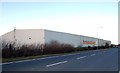
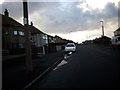
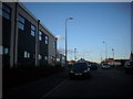
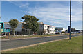
Photos of Fleetwood


Area Information
Fleetwood is a compact built-up area in England, spanning 6.7 km² and home to 8,536 residents. With a population density of 1,265 people per square kilometre, it’s a tightly knit community where daily life is shaped by proximity to amenities and transport links. The area’s character is defined by its mix of practical infrastructure and coastal accessibility, with ferry services to Knott End and rail connections to Poulton offering regional mobility. Fleetwood’s older demographic—median age 70—suggests a community with established roots, though it remains connected to nearby towns through retail hubs like Tesco and Spar, and five metro stops. Living here means navigating a balance between local convenience and the broader regional network, with a focus on accessible services rather than sprawling development. The area’s compact size ensures that most essentials are within walking or cycling distance, though its appeal may hinge on the suitability of its infrastructure for modern lifestyles.
- Area Type
- Built Up Area 250
- Area Size
- 6.7 km²
- Population
- 8536
- Population Density
- 1265 people/km²
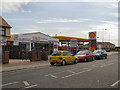
Residents of Fleetwood have access to a range of amenities within practical reach, including five retail outlets such as Tesco Fleetwood, Spar Fleetwood, and Aldi Freeport. The area’s five metro stops provide easy access to public transport, while two ferry services connect to Knott End. Rail links to Poulton offer regional travel options. Though the data does not specify parks or leisure facilities, the presence of multiple retail and transport hubs suggests a focus on convenience over expansive recreational spaces. The compact nature of Fleetwood means most amenities are within walking distance, fostering a community-oriented lifestyle. However, the absence of detailed information on green spaces or cultural venues leaves gaps in understanding the area’s leisure offerings.
Amenities
Schools
Fleetwood is served by five primary schools, including Flakefleet County Junior School, Flakefleet Infant School, Charles Saer Community Primary School, Larkholme Primary School, and Shakespeare Primary School. Charles Saer has an Ofsted rating of satisfactory, while Larkholme and Shakespeare are rated good. This mix of ratings offers families a range of options, from schools with standard performance to those with stronger educational outcomes. The presence of multiple primary schools suggests a focus on local education, though the data does not include secondary schools or further education institutions. Families prioritising school quality may need to assess individual ratings and proximity to their homes, as the area’s compact size means travel times to schools are likely to be short.
| Rank | A + A* % | School | Type | Entry gender | Ages |
|---|---|---|---|---|---|
| 1 | N/A | Flakefleet County Junior School | primary | N/A | N/A |
| 2 | N/A | Flakefleet Infant School | primary | N/A | N/A |
| 3 | N/A | Charles Saer Community Primary School | primary | N/A | N/A |
| 4 | N/A | Larkholme Primary School | primary | N/A | N/A |
| 5 | N/A | Shakespeare Primary School | primary | N/A | N/A |
Explore more schools in this area
Go to Schools tabDemographics
Fleetwood’s population has a median age of 70, indicating a community skewed toward older residents. This age profile shapes the area’s social dynamics, with a focus on stability and long-term residency. Home ownership stands at 62%, suggesting a majority of residents live in properties they own, though the data does not specify the types of households or accommodation. The absence of detailed breakdowns on ethnicity, religion, or household composition means these aspects remain unexplored in the provided data. For those considering Fleetwood, the older demographic may influence local services and amenities, with a focus on accessibility and community support. The lack of specific figures on deprivation or diversity means these factors cannot be contextualised further, but the existing data highlights a population that is largely settled and property-owning.
Household Size
Accommodation Type
Tenure
Ethnic Group
Religion
Household Composition
Age
Household Deprivation
NS-SEC
Explore more demographic insights in this area
Go to Demographics tabPlanning
Planning Constraints
- Crime RiskLocked