Area Overview for Fence
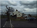
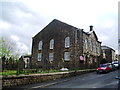
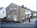
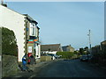
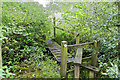
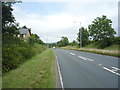
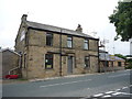
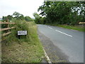
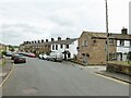
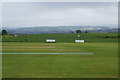
Photos of Fence


Area Information
Fence is a compact built-up area in England, covering 52.5 hectares. It is a place where older residents form the majority, with a median age of 70, suggesting a community shaped by long-term settlement. The area is predominantly owner-occupied, with 82% of homes in private hands, indicating stability and a focus on long-term residency. Living in Fence means access to essential services, including five nearby railway stations such as Brierfield and Nelson, which connect to broader networks. The area’s small size fosters a sense of proximity to amenities, from retail outlets like Morrisons Daily to primary schools. While the demographic data highlights an older population, the presence of two primary schools—Wheatley Lane Methodist Voluntary Aided Primary School and Wheatley Lane Methodist Primary School—suggests a commitment to local education. For those considering homes in Fence, the blend of practical connectivity and a mature community offers a distinct contrast to more transient or younger-focused areas.
- Area Type
- Built Up Area 250
- Area Size
- 52.5 hectares
- Population
- Not available
- Population Density
- Not available
Life in Fence is supported by a range of nearby amenities, including five railway stations and five retail outlets. The retail options include major chains such as Morrisons Daily and Asda Hollin, ensuring easy access to groceries and household goods. The area’s compact size means these services are within walking or short driving distance, enhancing convenience. While the data does not specify parks or leisure facilities, the presence of multiple retail and transport hubs suggests a practical, community-focused lifestyle. Residents can enjoy the ease of shopping, commuting, and connectivity without needing to travel far. The blend of rail access and retail options contributes to a balanced daily life, where essentials are never far away.
Amenities
Schools
Residents of Fence have access to two primary schools: Wheatley Lane Methodist Voluntary Aided Primary School and Wheatley Lane Methodist Primary School. Both are primary institutions, though the data does not include Ofsted ratings or academic performance metrics. The presence of two schools suggests a focus on local education, likely serving the area’s children and families. For parents, the proximity of these schools reduces commuting time and supports a community-oriented lifestyle. While no details on secondary education are provided, the availability of primary schooling is a key factor for families considering homes in Fence. The schools’ names and types are explicitly listed, but their quality remains unassessed in the data.
| Rank | School | Type | Entry gender | Ages |
|---|
Explore more schools in this area
Go to Schools tabDemographics
The population of Fence is predominantly older, with a median age of 70. This suggests a community where retirement is the norm, and long-term residency is common. Home ownership is high at 82%, reflecting a stable housing market with few rental properties. The data does not specify household composition or accommodation types, but the high home ownership rate implies a mix of family homes and single-occupancy properties. The area’s demographic profile lacks details on ethnic diversity or religious composition, but the absence of specific figures does not indicate a lack of diversity—only that the data is aggregated. For quality of life, the older population may mean a quieter, more established environment, though it could also signal fewer amenities tailored to younger families. The area’s character is defined by its mature demographic and the practicality of its housing stock.
Household Size
Accommodation Type
Tenure
Ethnic Group
Religion
Household Composition
Age
Household Deprivation
NS-SEC
Explore more demographic insights in this area
Go to Demographics tabPlanning
Planning Constraints
- Crime RiskPremium