Area Overview for Fazakerley West Ward
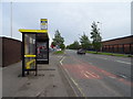
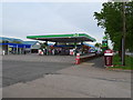
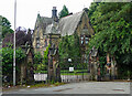
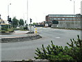
Photos of Fazakerley West Ward
Area Information
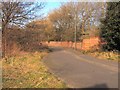
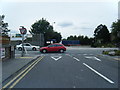
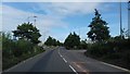
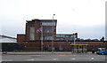
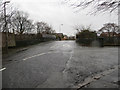
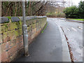
Living in Fazakerley West Ward means residing in a compact district within the city of Liverpool. This ward covers just 2.7 km², creating a dense environment where daily needs are concentrated. You are entering a community defined by an exceptionally older population, with a median age of 70 years. This demographic profile shapes the local rhythm, favouring quieter streets and services tailored to retirees rather than young families seeking active play areas or nightlife. The area sits within the borough unitary ward structure of Fazakerley, offering a specific administrative identity that often includes proximity to the hospital and surrounding industrial zones. Daily life here is practical and settled. While you will find a tight-knit group of long-term residents, the very high age statistic suggests a dynamic that requires you to consider accessibility and quiet when viewing properties. You are choosing a neighbourhood where time moves slower, dominated by those who have called it home for decades. Understanding this context is vital before purchasing a home in Fazakerley West Ward, as the physical layout and social fabric are inextricably linked to the ages of its inhabitants.
- Area Type
- District Borough Unitary Ward
- Area Size
- 2.7 km²
- Population
- Not available
- Population Density
- Not available
Demographics
The community in Fazakerley West Ward is distinctly mature, reflecting a neighbourhood matured by time rather than growth. With a median age of 70, you are looking at an area where the majority of residents are seniors. This age distribution influences how the estate is used, with less foot traffic from children and fewer night-time activities compared to newer parts of the city. Home ownership stands at 46%, indicating that roughly half of the homes are rented. This balance between owner-occupation and renting suggests a housing stock that has seen significant change over recent years or attracts tenants looking for affordable accommodation. The ward lacks specific breakdowns for household composition by family size, but the overall age data implies larger proportions of empty nesters or singles living alone. Accommodation types are not itemised in the available figures, yet the high ownership percentage hints at a mix of established homes rather than purpose-built apartments. Ethnic and religious demographics are not explicitly detailed in the current dataset, meaning the community feels defined primarily by its age rather than diverse cultural enclaves. When you research living in Fazakerley West Ward, the most defining statistic is that simple: half the residents own their homes.
Household Size
Accommodation Type
Tenure
Ethnic Group
Religion
Household Composition
Age
Household Deprivation
NS-SEC
Explore more demographic insights in this area
Go to Demographics tabPlanning
Planning Constraints
- Flood RiskPremium
- Ramsar Wetland SitesPremium
- Area of Outstanding Natural BeautyPremium
- Protected Nature ReservePremium
- Protected WoodlandPremium
- Crime RiskPremium