Area Overview for Fazakerley East Ward
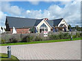
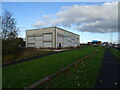
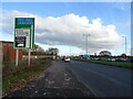
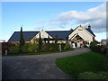
Photos of Fazakerley East Ward

Area Information
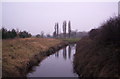
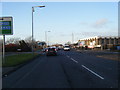
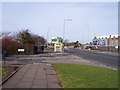
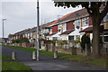
Fazakerley East Ward stands as a compact residential district within Liverpool, covering an area of just 2.6 square kilometres. This small footprint defines a tightly knit neighbourhood where daily life revolves around local amenities and close proximity to key services. Living in Fazakerley East Ward offers the advantage of a contained environment where residents can navigate the ward with ease. The location provides a distinct identity separate from the wider city, offering a sense of local community within a defined geographical boundary. This area serves as a functional part of the borough, balancing residential needs with access to essential infrastructure. For those researching homes in Fazakerley East Ward, the scale of the ward suggests a focused, accessible locale. The compact size means that essential services and community hubs are likely located close to residential streets. This ward represents a specific slice of Liverpool, characterised by its manageable scale and clear administrative boundaries. Prospective buyers will find that the area offers a straightforward living arrangement without the sprawling distances often found in larger districts. The identity of Fazakerley East Ward is firmly rooted in its role as a defined unitary ward within the broader fabric of the city.
- Area Type
- District Borough Unitary Ward
- Area Size
- 2.6 km²
- Population
- Not available
- Population Density
- Not available
Demographics
The community profile of Fazakerley East Ward reveals an older demographic, with a median age of 70 years. This indicates that the population consists largely of retirees or long-term residents rather than young families or workers. The household composition data does not provide specific breakdowns by family size, suggesting a potential prevalence of single-occupancy homes or smaller household units typical of older age groups. Home ownership levels stand at 50%, meaning exactly half of the residents own their properties outright or with a mortgage. This statistic highlights a mixed market where both owners and tenants coexist in significant numbers. The accommodation type data aggregates all forms without distinction, so specific details on detached versus semi-detached housing remain general. Ethnic diversity and religious makeup are categorised by totals in the available information, indicating a need to view the area's diversity through official census aggregates. The age distribution shows that the 'Total' age category represents the most common grouping, reinforcing the elderly nature of the population. Residents can expect a quieter dynamic compared to younger urban wards, driven by the high median age. This demographic reality shapes local service needs and the general pace of life within Fazakerley East Ward.
Household Size
Accommodation Type
Tenure
Ethnic Group
Religion
Household Composition
Age
Household Deprivation
NS-SEC
Explore more demographic insights in this area
Go to Demographics tabPlanning
Planning Constraints
- Flood RiskPremium
- Ramsar Wetland SitesPremium
- Area of Outstanding Natural BeautyPremium
- Protected Nature ReservePremium
- Protected WoodlandPremium