Area Overview for Elton Ward
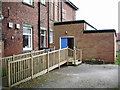
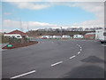
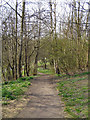
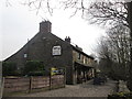
Photos of Elton Ward

Area Information
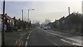
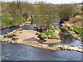
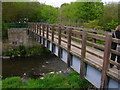
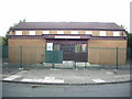
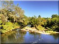
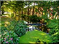
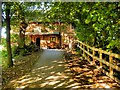
Elton Ward is a compact district within the Borough of Bury, covering just 3.6 square kilometres. You will find a distinct community here, situated in Greater Manchester with a current population of 2,013 residents. Living in Elton Ward means navigating a space where history meets heritage tourism. The area serves as a suburb and former township of Bury, rooted deeply in the region's industrial past. Evidence of settlement dates back to early Roman times, with 1st-century pottery found in Berryleas Field. This historical layering creates a unique character for anyone exploring homes in Elton Ward. Daily life revolves around significant locally important sites. Elton Recreation Ground stands as a central feature, donated by Henry Whitehead and opened in 1886 as Bury's first public recreation ground. The landscape also includes remnants of medieval and industrial innovation, such as the Haslam estate, which was once held by the Knights Hospitallers, and surviving weavers' cottages from the 18th century. Transport links are defined by the East Lancashire Railway heritage line, where Elton operates as a halt. These tangible assets provide a factual backdrop for your living experience, distinct from generic suburban developments. The area combines a quiet residential feel with accessible historical transport routes.
- Area Type
- District Borough Unitary Ward
- Area Size
- 3.6 km²
- Population
- 2013
- Population Density
- 558 people/km²
Demographics
The community living in Elton Ward has an exceptionally older population profile. Your potential neighbours in this ward have a median age of 70 years old. Census data confirms that the most populated age range spans significantly towards the end of life, suggesting a settlement of long-term residents or those retiring to the area. With a population density of 558 people per square kilometre, Elton Ward feels populated despite its small size of 3.6 km². You will find a high degree of stability in households here. Over 73% of residents own their homes outright, indicating a community invested in the locality rather than transient tenants. Accommodation types and household compositions are stable but do not reveal specific numbers in the current data. You can assume a traditional mix of single-family homes and smaller terraced cottages fitting the historic character. The demographic profile suggests you are buying into a neighbourhood where quiet streets meet an elderly demographic. If you are seeking active family hubs, the age data indicates you should look elsewhere. Conversely, if you desire a peaceful environment with established owners, Elton Ward aligns with your requirements. The population figures and ownership rates speak clearly to a settled, mature community without rapid turnover.
Household Size
Accommodation Type
Tenure
Ethnic Group
Religion
Household Composition
Age
Household Deprivation
NS-SEC
Explore more demographic insights in this area
Go to Demographics tabPlanning
Planning Constraints
- Flood RiskPremium
- Ramsar Wetland SitesPremium
- Area of Outstanding Natural BeautyPremium
- Protected Nature ReservePremium
- Protected WoodlandPremium
- Crime RiskPremium