Area Overview for Egton with Newland
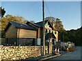
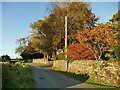
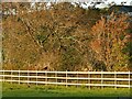
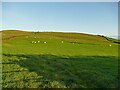
Photos of Egton with Newland
Area Information
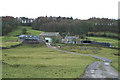
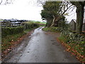
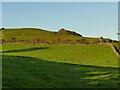
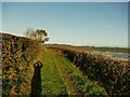
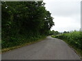
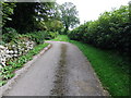
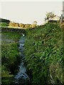
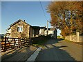
Living in Egton with Newland means embracing a completely rural existence spread across a parish covering 17.8 square kilometres. This civil parish is defined by its isolation and natural setting rather than urban amenities. You will find no large towns or major commercial centres within these bounds, so your daily life revolves around the immediate local environment. The area attracts those seeking a quiet retreat away from the noise and pace of larger settlements. Expect a lifestyle where distance is a constant factor in your routine. There are no shortcuts here; everything requires planning and travel to accessible locations outside the parish. The character of the settlement is shaped by its history and geography, offering a distinct pace of living that suits specific types of homebuyer. If you value silence and open space above all else, this location delivers exactly that. However, convenience comes at a premium. You must weigh the beauty of the countryside against the practicalities of accessing shops, services, and employment hubs. Your days will largely be dictated by the roads connecting you to the wider world. This is a place for those committed to a slower rhythm and willing to accept that immediate convenience is not part of the experience. The parish stands as a secluded pocket of England, demanding independence from the traditional city-centre lifestyle.
- Area Type
- Parish
- Area Size
- 17.8 km²
- Population
- Not available
- Population Density
- Not available
Demographics
The community in Egton with Newland presents a distinctly older demographic profile. The median age for residents is 70 years, indicating that the population is significantly skewed towards the over-60s age group. This statistic defines the social fabric of the parish, suggesting that co-operation and services are tailored for an elderly population rather than young families or professionals. Data on household composition is recorded generally, but the age profile provides the clearest indicator of who lives here. Home ownership stands at an impressive 79 per cent, meaning that nearly four out of five households are owned outright or with a mortgage. This high rate suggests stability and long-term residency, rather than a transient rental market. You will therefore encounter established residents who have likely lived in the area for decades. There is no specific data available to break down ethnic groups or religious affiliations, so the diversity of the community remains statistically unquantified in current records. Deprivation levels are not detailed in the available information, making it difficult to assess economic disparities within these streets. The prevailing picture is of a settled, older community where property is predominantly owned by those remaining in this rural retirement setting.
Household Size
Accommodation Type
Tenure
Ethnic Group
Religion
Household Composition
Age
Household Deprivation
NS-SEC
Explore more demographic insights in this area
Go to Demographics tabPlanning
Planning Constraints
- Flood RiskPremium
- Ramsar Wetland SitesPremium
- Area of Outstanding Natural BeautyPremium
- Protected Nature ReservePremium
- Protected WoodlandPremium
- Crime RiskPremium