Area Overview for Earby & Coates Ward
Photos of Earby & Coates Ward


Area Information
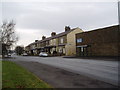
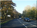
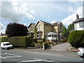
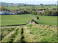
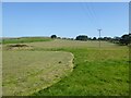
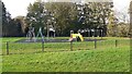
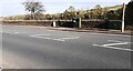
Living in Earby & Coates Ward means residing within a compact district spanning 24.5 km² in Pendle Borough Council. This electoral ward encompasses the town of Earby and the former Coates area, creating a specific rural locality within North West England. The area feels intimate, defined by an electorate of 6,520 people as of recent boundary reviews, though the specific ward population registers at 1,450. You will find yourself in a setting shaped by shifts in local governance, having moved from the West Riding of Yorkshire to Lancashire in 1974. The geography includes locations near specific coordinates of approximately 53.9056°N, 2.1536°W, placing it firmly in the textile heritage regions of the county. Daily life here revolves around a community rooted in history, including Coates which was a civil parish abolished in 1923 with a 1921 population of 392 before merging into Barnoldswick. This backdrop provides a distinct character different from larger urban centres. Homes in Earby & Coates suit those seeking a location with established boundaries and a clear sense of place rather than rapid development. The ward represents a settled environment where residents benefit from a consistent historical identity without the noise of major industrial expansion.
- Area Type
- District Borough Unitary Ward
- Area Size
- 24.5 km²
- Population
- 1450
- Population Density
- 59 people/km²
Demographics
The community in Earby & Coates Ward presents a distinctly mature demographic profile. The median age stands at 70, indicating an area populated primarily by retirees or older generations. This age structure influences the pace of life and the nature of local social activities. You will encounter a household where stability is common, evidenced by an exceptionally high home ownership rate of 72%. This figure suggests that most residents have lived in their properties for significant periods, reinforcing the sense of belonging within the ward. The data provided does not specify metrics for youth families or young professionals seeking entry-level rentals, though the high ownership rate implies a market focused on long-term settlement. Accommodation types, ethnicity, and religion figures are noted as totals in the source data, reflecting the comprehensive nature of the census records for this entire ward. There is no indication of transient populations or short-term lets dominating the landscape. Instead, the social fabric appears woven from decades of local continuity. When considering living in Earby & Coates Ward, you must accept that the daily rhythm aligns with the lifestyles of an older population, offering quiet streets and established neighbours rather than a younger, mobile cohort.
Household Size
Accommodation Type
Tenure
Ethnic Group
Religion
Household Composition
Age
Household Deprivation
NS-SEC
Explore more demographic insights in this area
Go to Demographics tabPlanning
Planning Constraints
- Flood RiskPremium
- Ramsar Wetland SitesPremium
- Area of Outstanding Natural BeautyPremium
- Protected Nature ReservePremium
- Protected WoodlandPremium
- Crime RiskPremium