Area Overview for Dunham-on-the-Hill and Hapsford
Photos of Dunham-on-the-Hill and Hapsford

Area Information
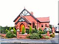
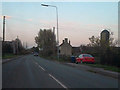
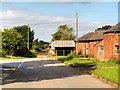
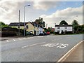
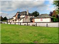
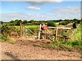
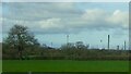
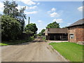
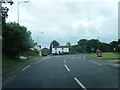
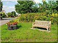
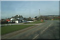
The civil parish of Dunham-on-the-Hill and Hapsford occupies an 8.1 square kilometre expanse in North West England, ten years after its formation in 2015 from the former parish of Dunham-on-the-Hill. The settlement retains a distinct semi-rural character despite gradual enlargement during the twentieth century. Its name derives from Old English *dūn*, meaning a hill, and *hām*, meaning a village. Originally recorded as 'Doneham' in the Domesday Book of 1086, the area has passed through various historical designations including Stoney Dunham and Dunham Super Montem before establishing its current title by 1860. Though the population declined slightly between the 2001 and 2011 censuses, moving from 534 to 501 residents, the village maintains a feeling of solid continuity. This stems from a concentration of listed buildings dating largely to the 17th, 18th, and 19th centuries. Landmarks such as Dunham Hall, a Grade II listed manor house, and the Church of St Luke define the built environment. The Church of St Luke originally served as a chapel of ease in the 1860s, implanted in decorated English style to serve villagers who previously walked across fields to Thornton-le-Moors for religious services. Today, the area presents a quiet residential setting where the name invokes centuries of history, from the Battle of Agincourt to the modern conservation area status granted in April 1979.
- Area Type
- Parish
- Area Size
- 8.1 km²
- Population
- Not available
- Population Density
- Not available
Demographics
Residents of Dunham-on-the-Hill and Hapsford form a very settled community, evidenced by a home ownership rate of 74%. This high level of tenure suggests a population that has put down roots, with most households likely living in properties they own outright or through a mortgage. The demographic profile is notable for an older population, with a median age of 70 years. This indicates that the village serves primarily families with children reaching adulthood or retirees rather than young professionals seeking to start their careers here. The household composition reflects this stability, though specific breakdowns for different age groups are not detailed in current census releases. The area does not show significant concentrations of minority ethnic groups; the predominant ethnic group remains white British, which is typical for many rural parishes in the region. Religious diversity is similarly low, with no specific religious affiliations recorded as predominant beyond the general Christian heritage often found in historic villages. The population density remains low relative to urban centres, contributing to a lifestyle where neighbours know one another well. This demographic reality fosters a quiet environment where daily life revolves around local amenities and community groups rather than the fast pace of city living.
Household Size
Accommodation Type
Tenure
Ethnic Group
Religion
Household Composition
Age
Household Deprivation
NS-SEC
Explore more demographic insights in this area
Go to Demographics tabPlanning
Planning Constraints
- Flood RiskLocked
- Ramsar Wetland SitesLocked
- Area of Outstanding Natural BeautyLocked
- Protected Nature ReserveLocked
- Protected WoodlandLocked
- Crime RiskLocked