Area Overview for Duddon
Photos of Duddon


Area Information
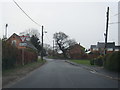
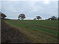
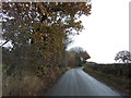
Duddon is a built-up area in England covering 27 hectares, offering a compact yet distinct living environment. Its population, while not specified in detail, is reflected in its demographic profile, with a median age of 70, suggesting a community shaped by older residents. The area is characterised by a strong sense of local identity, with a high home ownership rate of 78%, indicating a stable, long-term presence of residents. Daily life in Duddon is influenced by its proximity to nearby amenities, including retail outlets and rail stations, which provide practical access to essential services. The area’s small size means it is likely to have a close-knit feel, though it remains connected to broader regional networks through transport links. For those seeking a quieter, more established environment, Duddon offers a blend of simplicity and accessibility, with schools, shops, and transport options within practical reach. Its appeal lies in its balance between local charm and functional connectivity, making it a viable option for those prioritising stability and convenience.
- Area Type
- Built Up Area 250
- Area Size
- 27.0 hectares
- Population
- Not available
- Population Density
- Not available
Duddon’s residents have access to a range of nearby amenities, including five retail outlets such as Budgens Greenacre and Co-op Tarvin, which provide essential shopping options. These stores cater to daily needs, offering convenience for local residents. The area also features two rail stations, Mouldsworth and Delamere, which connect to broader transport networks and support commuting or leisure travel. While the data does not mention parks or leisure facilities, the combination of retail and rail access suggests a lifestyle that prioritises practicality and connectivity. The proximity to these amenities means daily life in Duddon is efficient, with services within easy reach. The character of the area is likely shaped by its compact size and the availability of nearby essentials, creating a self-contained yet connected living environment.
Amenities
Schools
Duddon is served by Duddon St Peter’s CofE Primary School, a primary institution with a good Ofsted rating. This school caters to younger families, offering a foundation for early education within the community. The absence of secondary schools in the data means that families may need to look further afield for secondary education, but the primary school’s rating indicates a reliable starting point for children’s learning. The single school listed suggests a focused, community-oriented approach to education, though the data does not provide information on pupil numbers or additional educational facilities. For families prioritising primary schooling, Duddon’s school meets a key need, but broader educational planning would require considering nearby secondary options.
| Rank | A + A* % | School | Type | Entry gender | Ages |
|---|---|---|---|---|---|
| 1 | N/A | Duddon St Peter's CofE Primary School | primary | N/A | N/A |
Explore more schools in this area
Go to Schools tabDemographics
The demographic profile of Duddon reveals a population with a median age of 70, the highest recorded in the dataset. This suggests a community predominantly composed of older residents, which may influence local services and social dynamics. Home ownership is high, with 78% of households owning their homes, reflecting a settled population. The data does not specify household composition or accommodation types, but the overall figures indicate a stable, long-term demographic structure. The absence of detailed information on diversity or deprivation means the area’s social fabric remains largely undefined in the provided data. However, the high home ownership rate and age profile suggest a community with a strong emphasis on continuity and familiarity. For prospective buyers, this demographic context may align with preferences for established, low-maintenance living.
Household Size
Accommodation Type
Tenure
Ethnic Group
Religion
Household Composition
Age
Household Deprivation
NS-SEC
Explore more demographic insights in this area
Go to Demographics tabPlanning
Planning Constraints
- Crime RiskLocked