Area Overview for Downham
Photos of Downham
Area Information
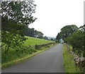
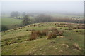
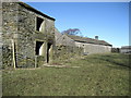
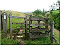
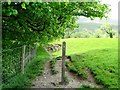
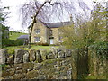
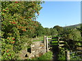
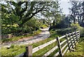
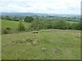
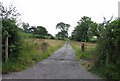
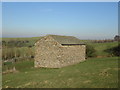
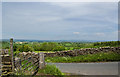
Downham is a civil parish situated within the county of England, covering a total area of 9.3 km². Living in Downham means residing in a relatively small settlement, where the landscape and community layout are defined by this compact footprint. The area offers a distinct character separate from larger urban centres, providing a setting where residents experience a quieter pace of life. You will find that daily living here is shaped by the specific boundaries and spatial organisation of this parish. The size of the location influences the proximity of homes, creating a neighbourhood feel that is tightly knit compared to sprawling developments. Every acre of the 9.3 km² contributes to the overall identity of the place, defining the distances you will travel for local amenities. This compact nature allows you to understand the full extent of what lives within the parish limits immediately. The area stands as a defined entity on the map, offering a clear sense of place for anyone considering their options. Your life in Downham will be centred around this specific geographic reality, where the scale of the parish dictates the rhythm of your daily routine.
- Area Type
- Parish
- Area Size
- 9.3 km²
- Population
- Not available
- Population Density
- Not available
Demographics
The community in Downham has a distinct age profile, with a median age of seventy. This figure indicates that the population is significantly older than national averages, suggesting a area where the majority of residents are senior citizens or retirees. Most households in Downham reflect this older demographic, creating a community feel that centres on later-life needs and preferences. Home ownership stands at sixty-six percent, revealing a area where owning a property is the norm rather than the exception. You can expect to find a high number of residents who have already purchased homes, building long-term roots in the parish. The accommodation stock largely aligns with this ownership rate, contributing to a stable and established neighbourhood atmosphere. Diversity metrics are recorded for the total population, providing a clear picture of the ethnic composition of the parish. Religious affiliation data covers the total resident population, completing the portrait of the social fabric. Living in Downham involves joining a community where ownership establishes itself as the primary housing arrangement, supported by a population that has settled into this specific locality.
Household Size
Accommodation Type
Tenure
Ethnic Group
Religion
Household Composition
Age
Household Deprivation
NS-SEC
Explore more demographic insights in this area
Go to Demographics tabPlanning
Planning Constraints
- Flood RiskPremium
- Ramsar Wetland SitesPremium
- Area of Outstanding Natural BeautyPremium
- Protected Nature ReservePremium
- Protected WoodlandPremium
- Crime RiskPremium